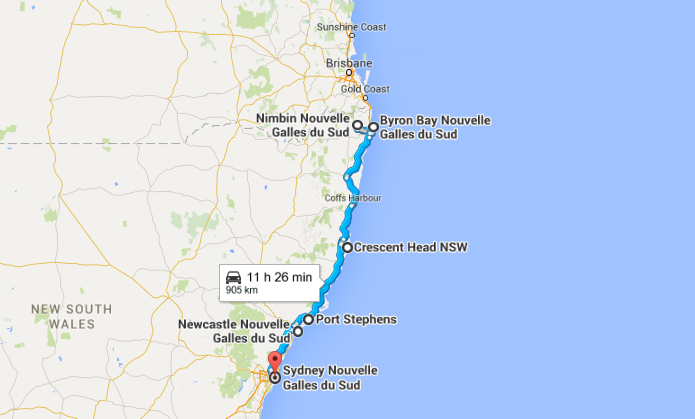
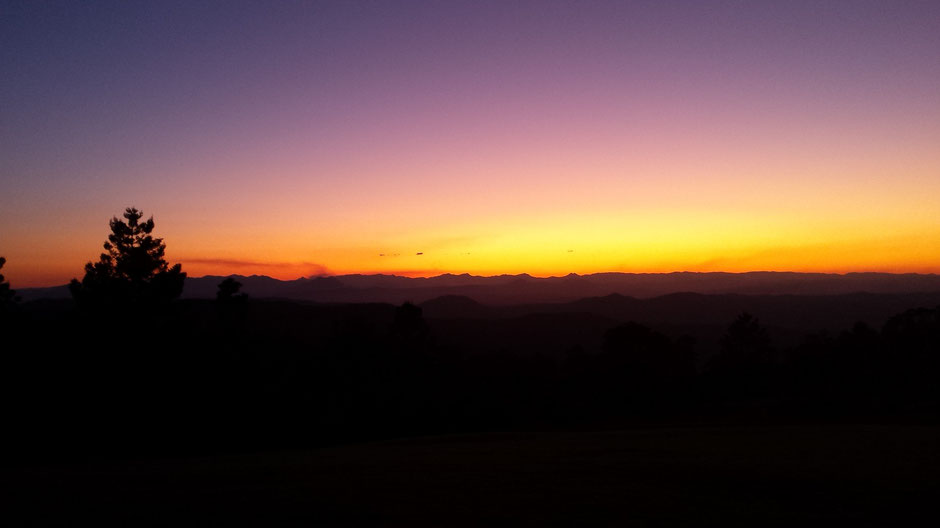
The NSW north coast or the home straight…
From Nimbin to Manly : a little more than 900 km, a good ten or so hours drive on the Pacific Highway…
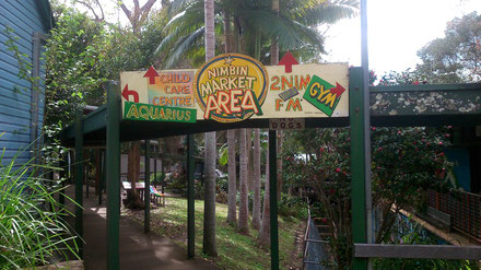
➳ Step 1 : Nimbin, the village of happiness
On the winding road to Nimbin, you’ll find tiny and timeless villages: art gallery, art school, market…
The vast area surrounding Nimbin is known as the rainbow region…
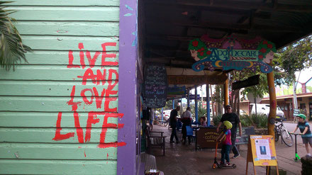
After few km in the countryside, we arrived in Nimbin. The village is characterized by brightly colored mural façade and shopfronts and the sweet smell of incense and other…
Nimbin has been famous for its annual MardiGrass festival, a festival supporting the legalization of cannabis.
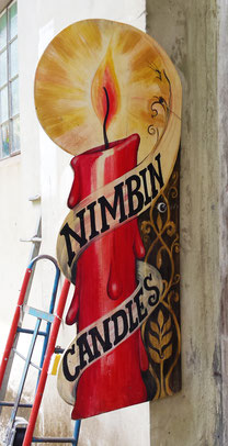
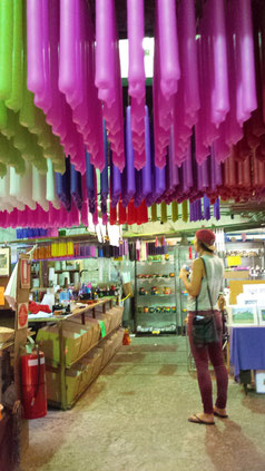
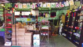
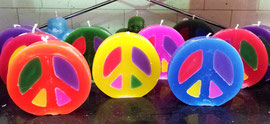
After a visit of the souvenir shop, we stopped at the Candle Factory located at the Old Butter Factory on Mulgum Creek. Nimbin Candles is an Australian Candle manufacturer, specializing in non-toxic, hand dipped, traditionally made candles.

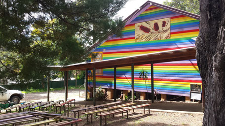
After our free visit of the Candle Factory, we sat outside and enjoyed a brink at the Nimbin Bush Beater. Originally a butter factory, the iconic Nimbin Bush Theatre is a
thriving live music venue and a cinema.
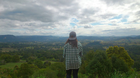
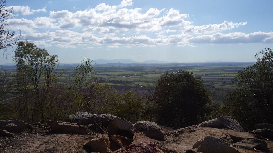
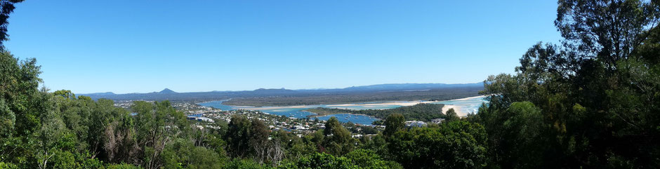
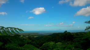
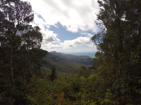
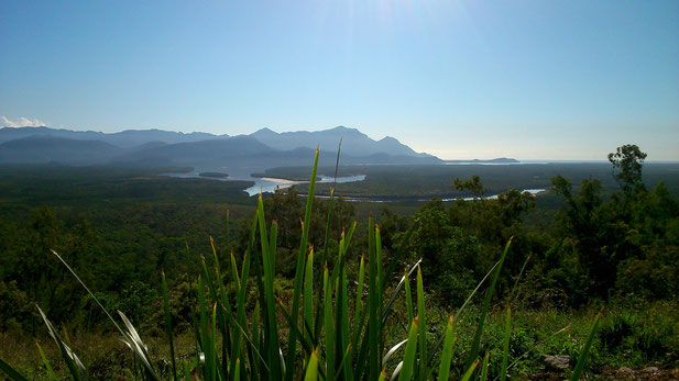
In the afternoon, we took the long and winding road though rainforest to Mount Nardi and we stopped at a lookout offering panoramic view of Nimbin countryside.
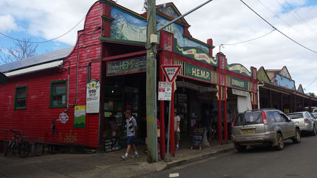
Back to Nimbin, we stopped at the Hemp Bar, a coffee managed by a French expat and his acolyte.
The day after, awake by a rooster, we said goodbye to Nimbin, a hippie and alternative place.
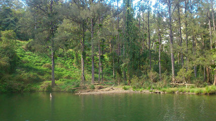
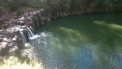
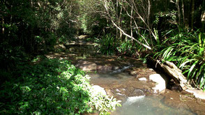
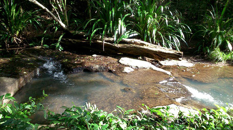
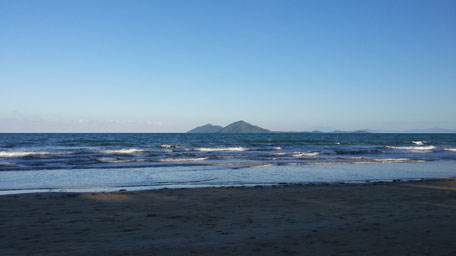
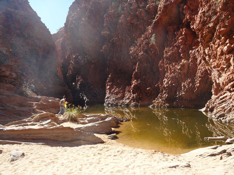
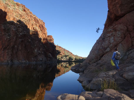
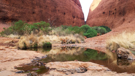
We planned to go to a special place. We first though at a legend! After 5 km drive, we found a waterhole and a beautiful waterfall « Hanging Rock Falls ».
In this magic place, we met a gold digger couple.
➳ Step 2 : Byron Bay
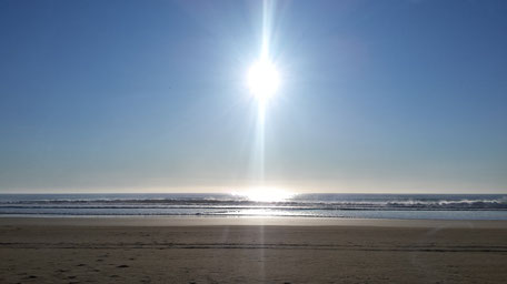
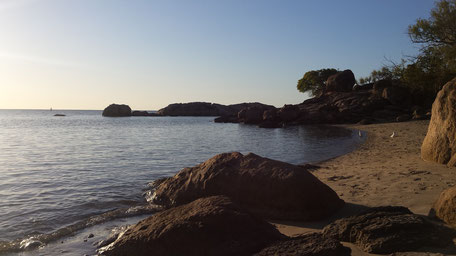
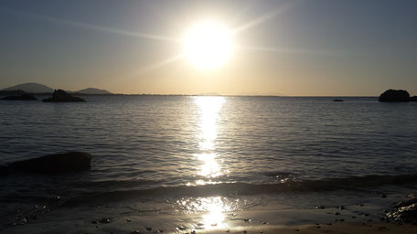
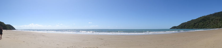
Byron bay, Australia's most easterly point, is famous for this beautiful beaches and its many surf sport such as Pass Beach.
We spent two days in this little city.
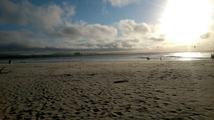
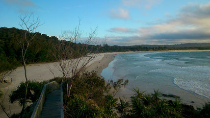
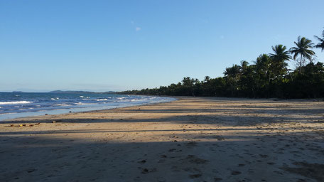
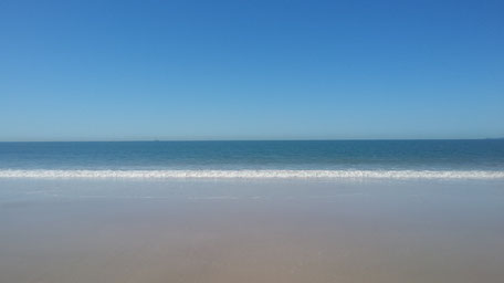
The second day, we relaxed at Tallow beach (for the first time!), an endless beach.
➳ Step 3 : on the road to South West Rock
After a stormy night, we woke up in the rain. Never discourage, we got back on the road !
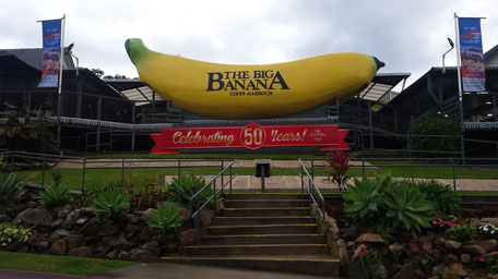
“Big Things” are now a form of artistic expression unique to Australia.
The Big Banana was one of Australia's first Big Things. Opened on 22nd December 1964, to advance the Banana industry and tourism in Coffs Harbour.
Then, we took a breakfast by the waterside in Grafton, a provincial city.
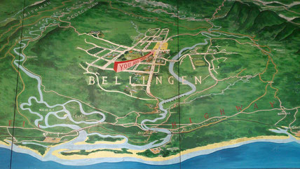
At the end of the day, we made a detour to explore the tiny village of Belligen: arts and craft in the Old Butter Factory, galleries and cafes.
➳ Step 4 : Crescent Head
The sun is back!
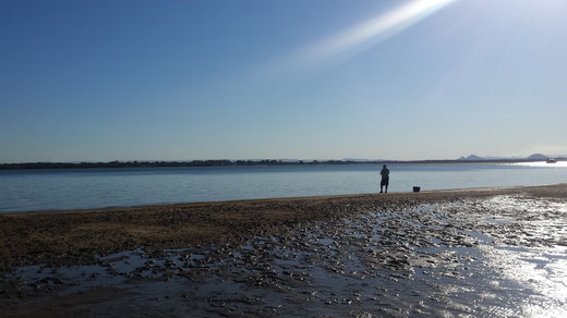
After a breakfast at South West Rock, we explored around...
After two km through tall grasses and heavy underbrush, we arrived to Horseshoes Bay Beach where we saw our first dolphin in Australia.
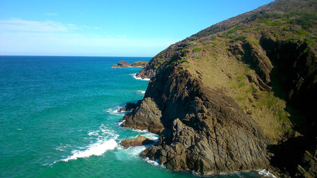
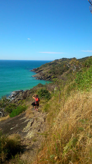
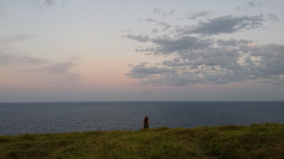
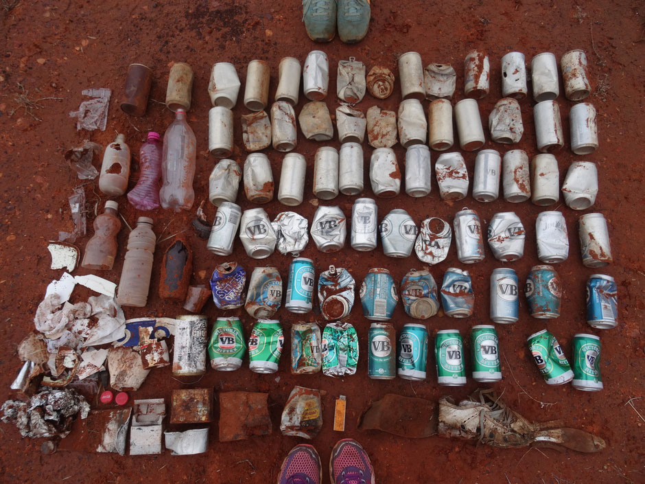
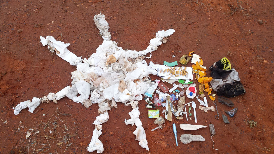
At the beginning of the afternoon, we decided to go for a little hike: Korogoro walking track on the easternmost tip of Hat Head National Park,
a 3,2 km hike offering exceptional coastal scenic views.
This afternoon was full of surprises. Actually, the view was absolutely breathtaking and above all a group whales put on a show for us!
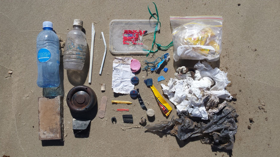
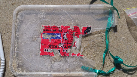
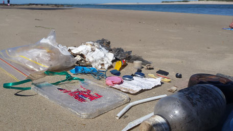
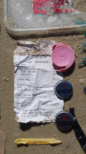
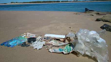
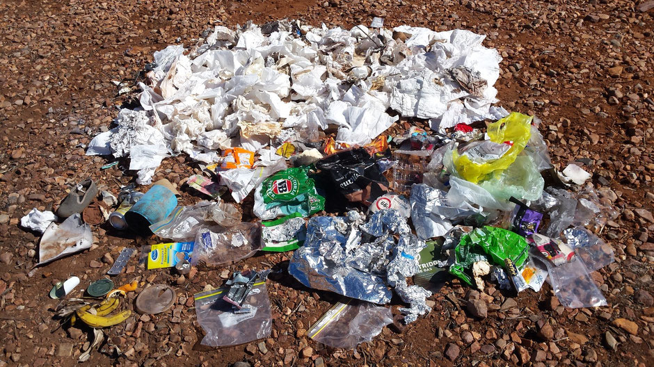
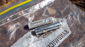
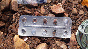
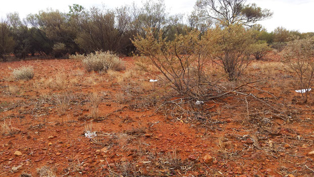
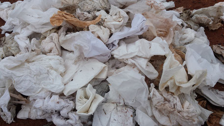
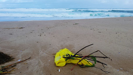
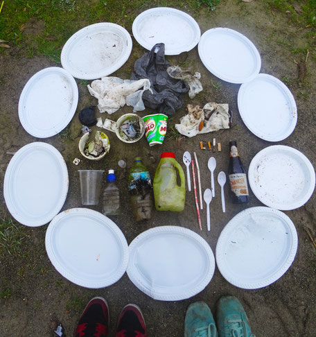
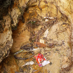
On our way, we made finds : shoes, toilet paper, plastic bottles, cans...
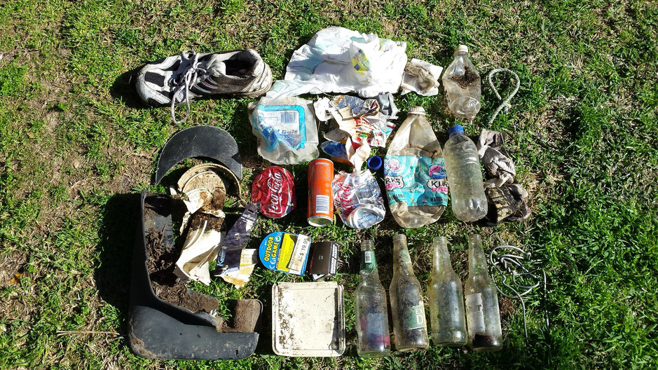
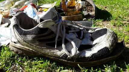
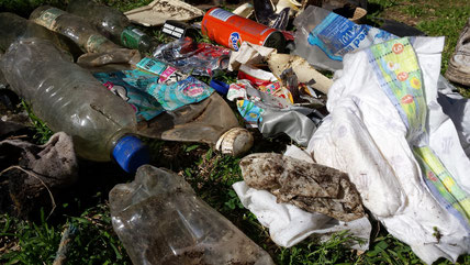
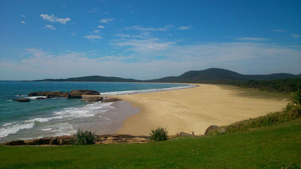
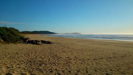
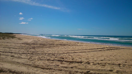
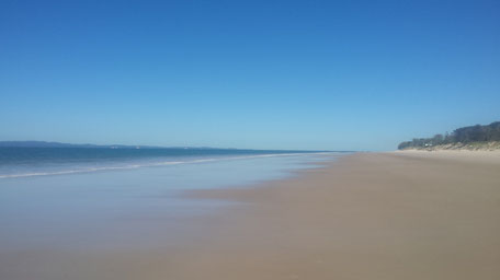
After this amazing hike... We had a swim at Hat Head Beach, a endless beach.
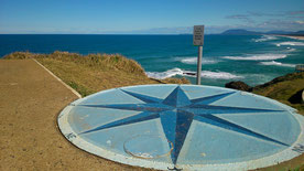
To come to the end of this beautiful day, we stopped at Crescent Head Lookout offering an incredible view on the coast.
From Crescent, we decided to stay at Racecourse Campground a great beach camping
site.
Early in the morning, we discovered a deserted beach. What Happiness!
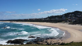
➳ Step 5 : Port Macquarie
Port Macquarie, an important step in our adventure.
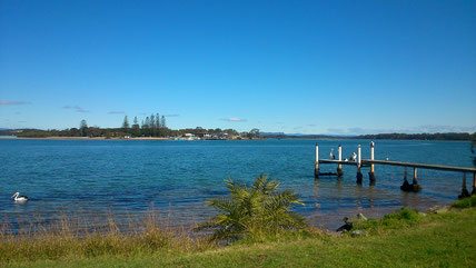
As we got there, we took a ferry to North Shore, a haven of peace.
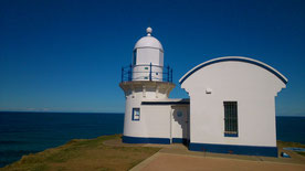
Port Macquarie, it's also beautiful beaches, a lighthouse and a koala hospital
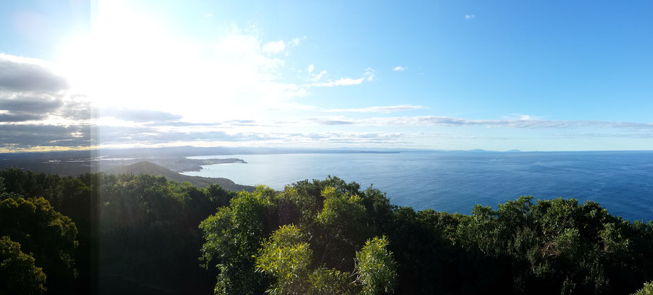
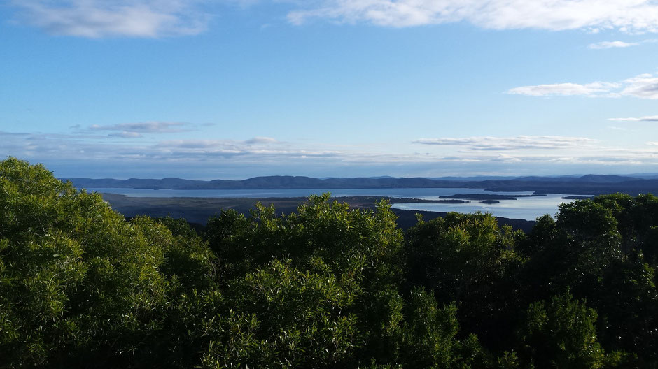
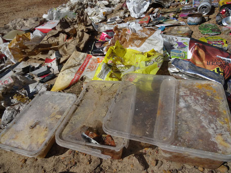
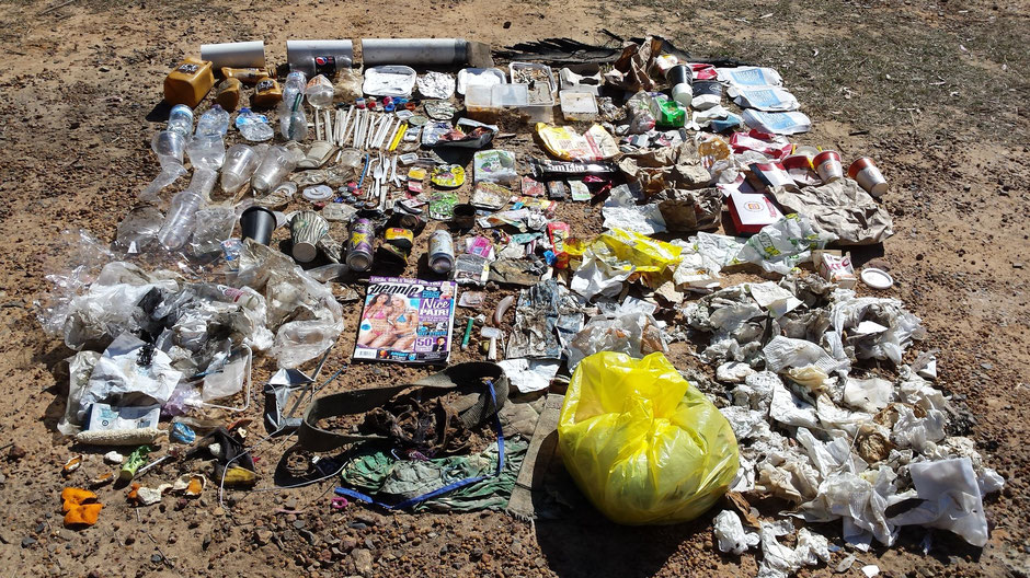
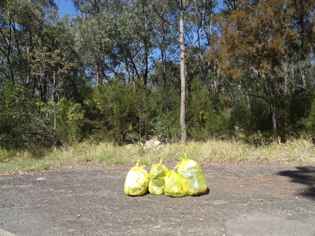
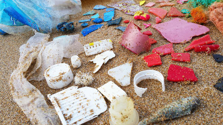
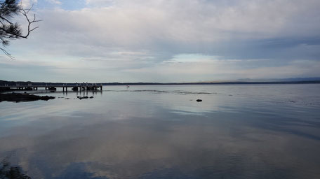
In the afternoon, we stopped in Foster, or more exactly at Cape Hawke lookout in the Booti Booti National Park, a amazing lookout.
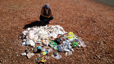
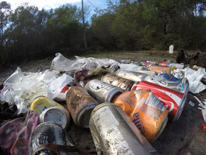
Despite some rubbish, the place was quite clean.
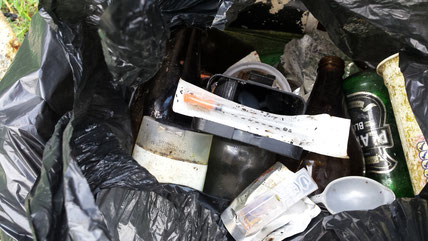
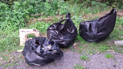
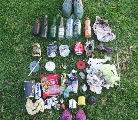
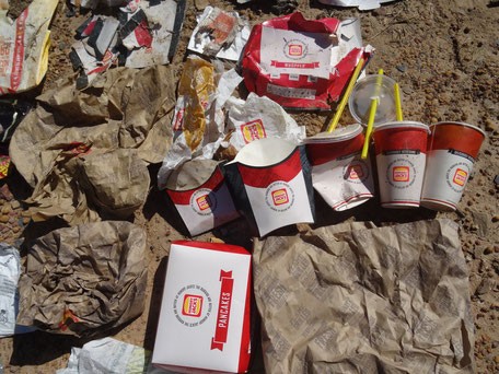
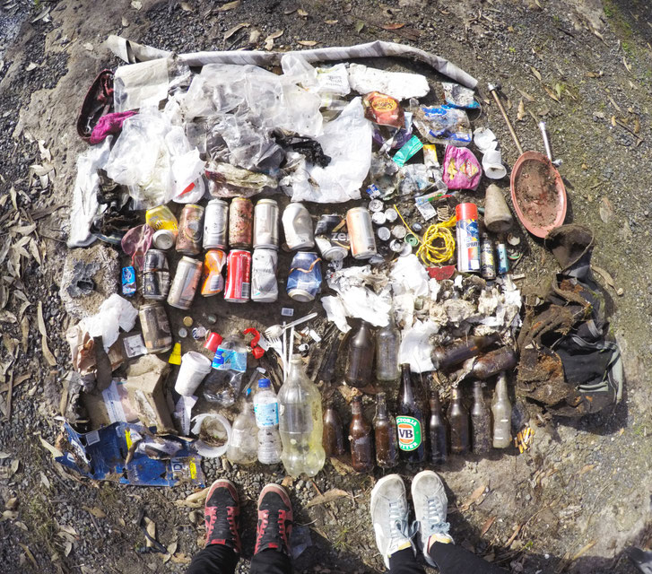
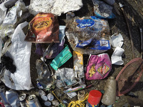
But an unpleasant surprise awaited us on the car park : clothes, bottles, needles...
After three trash bags, we stopped to clean up and alerted the council about that.
➳ Step 6 : Ports Stephens et Newcastle
The second to last Green Trip day was very busy.
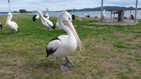
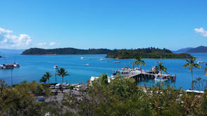
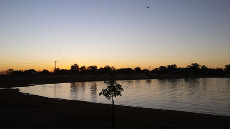
We started our day at Port Stephens. With 26 beaches, a vast bay and many inlets, Port Stephens is an idyllic beach getaway. Port Stephens is also home to around
150 bottlenose dolphins!
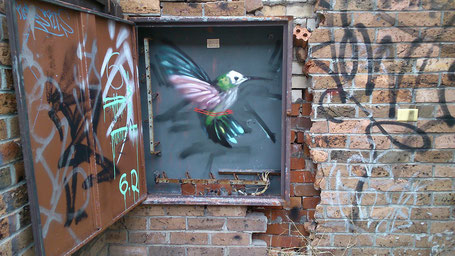
At the beginning of the afternoon, we explored Newcastle, the second most populated area in NSW. For many years, the industrial centre of Newcastle was once this city's lifeblood.
For us, Newcastle goes with street art, little boutiques and trendy bar.
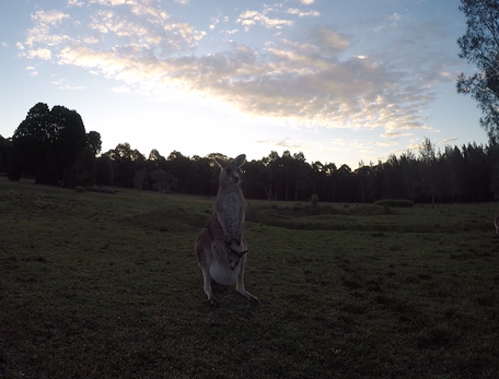
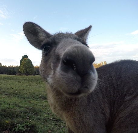
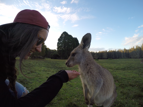
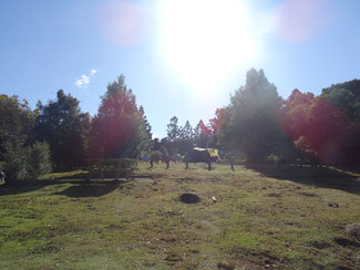
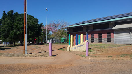
Located about 50 km of Newcastle, Morisset Park is the best place to spot the Kangaroos!
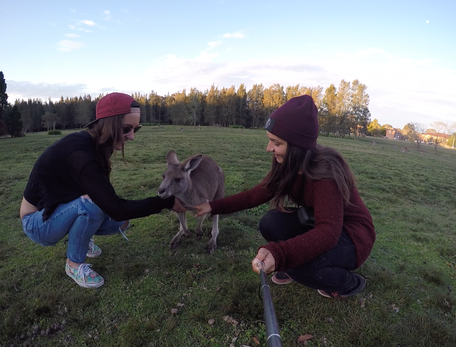
----------------------------------------
(Of course, feed kangaroos is PROHIBITED!)
----------------------------------------
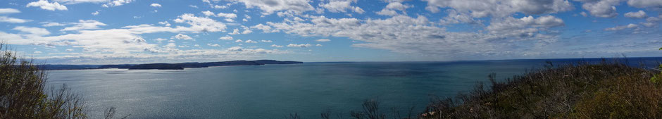
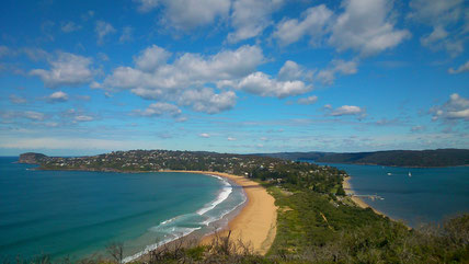
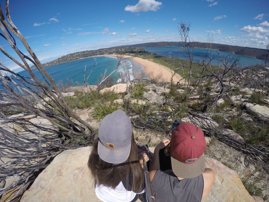
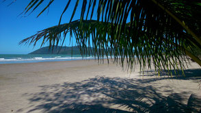
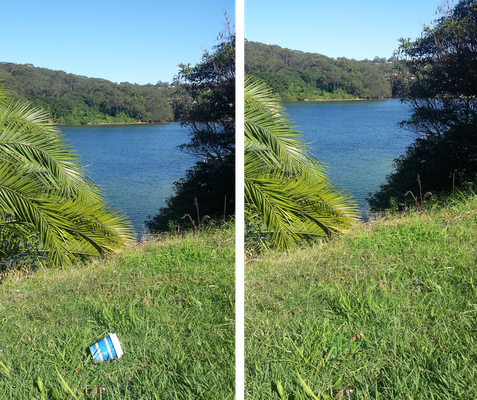
➳ Step 7 : Around Sydney : Palm Beach and Bondi Beach
All good things come to an end...
The Last Days of The Green Trip: Palm Beach and Bondi Beach.
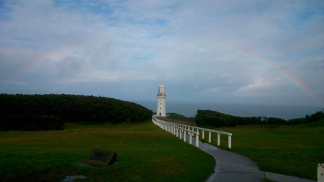
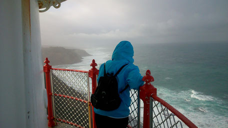
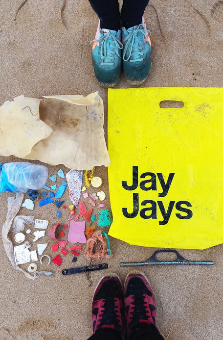
Palm beach, an exclusive suburbs in Sydney, sits at the end of a long peninsula. Barrenjoey Lighthouse stands at Barrenjoey Head at Palm Beach,
this heritage lighthouse is an iconic Palm Beach attraction.
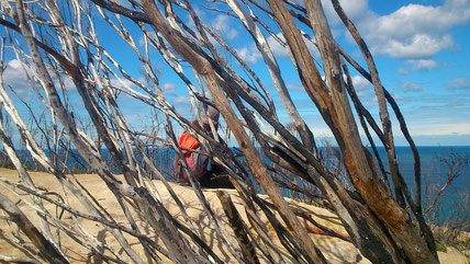
Positioned 91m above sea level, Barrenjoey lighthouse can be reached by a couple of walks. We took the Smugglers track to the top with a breathtaking view.
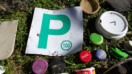
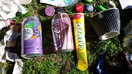
As usual, we picked up rubbish :
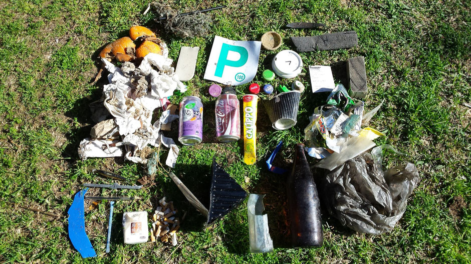
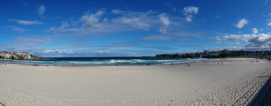
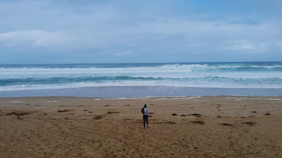
Our last stop was Bondi Beach, one of Australia's most famous beaches, located 10 kilometres from the city centre of Sydney. A must-see!
Bondi Beach is famous for its beach and seaside spirit but it's also a outdoor spot to see nice street art.
Here we are at the end of our adventure, your adventure in Australia.
THANK YOU ALL!
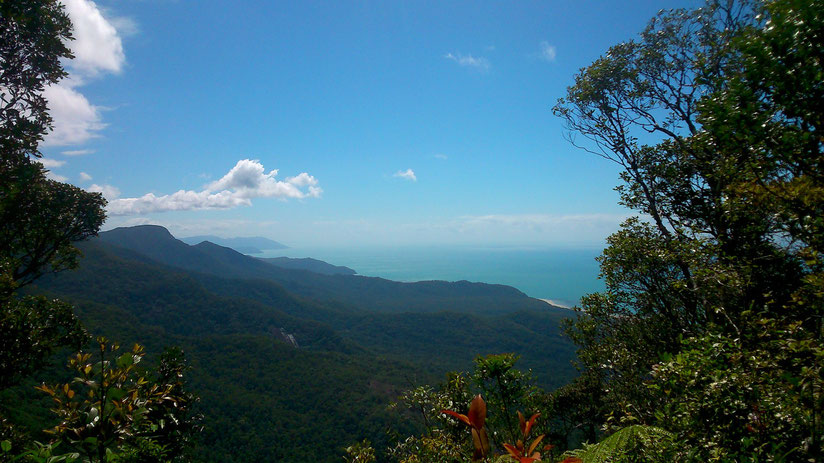
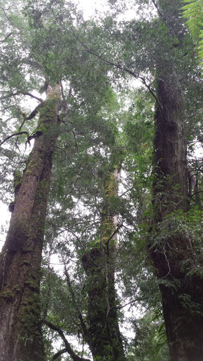
Lamington National Park
Located 45 km from the Gold Coast, Lamington, one of Queensland’s most popular national park, is characterised by a series of densely forested valleys and ranges and an extensive subtropical
rainforest. Lamington National Park has had World Heritage status since 1994 and encapsulates an area of over 20 000 hectares of rainforest, waterfalls and an incredible variety of
wildlife.
After 30 km on a long, narrow and winding roads (very, very long, narrow and winding) to the Green Mountains, here we arrived in the campground, the only camping area in the
Green Mountains section of Lamington National Park.
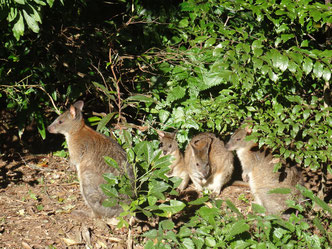
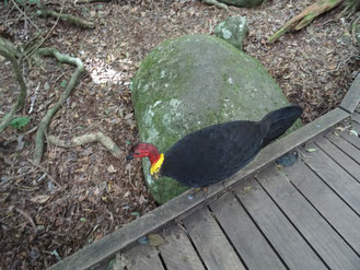
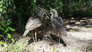
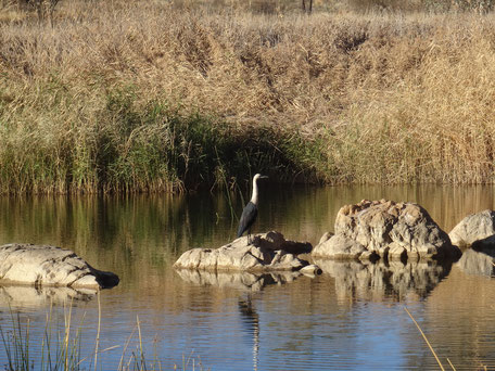
A peaceful bush camp where we cohabited with the brush-turkeys, the noisy-pitta, the long-nosed bandicoot and the pademelons.
Peaceful? Awake at 6:30 am by a brush-turkeys on the roof and a noisy-pitta, we went to the Green Mountain Visitor Center.
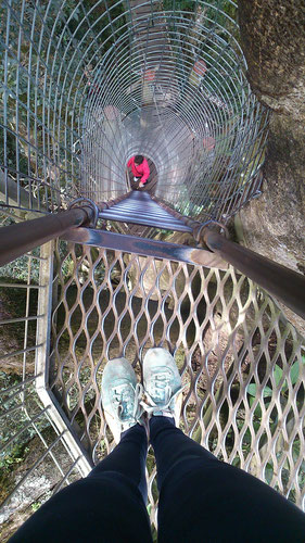
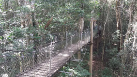
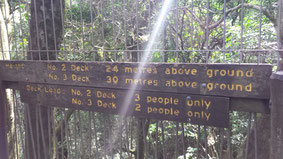
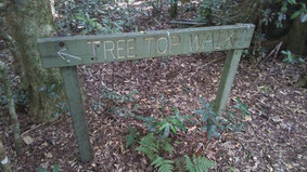
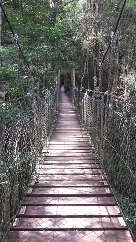
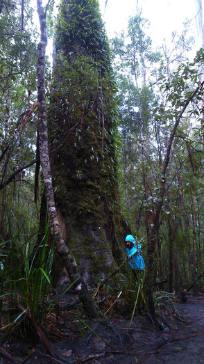
Map in hand, we have done the Tree Top Walk. This walk consists of 9 suspension bridges up to 15 metres above ground. We enjoyed the impressive trees including the giant fig tree
and the birdlife over the walk.
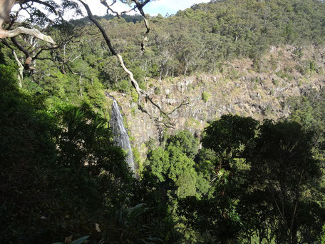
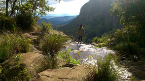
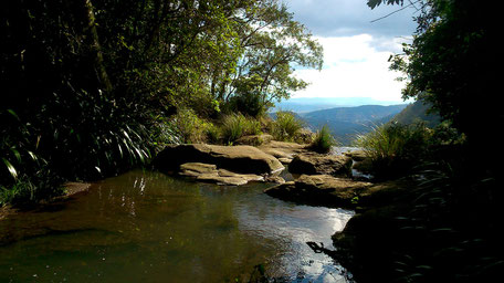
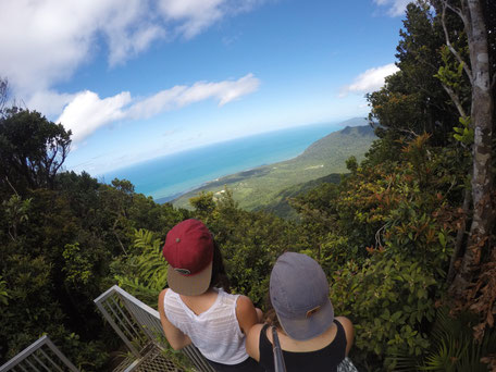
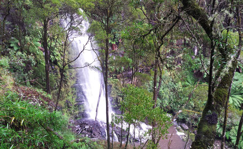
In the afternoon, we started the Morans Falls Tracks (4,4 km return), offering an excellent views of Morans Falls and Morans Creek gorge
through a rainforest of booyongs, figs and brush box.
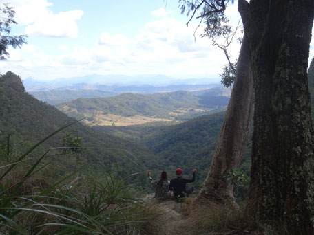
An amazing views of the Mt Lindesay, Mt Barney and Mt Maroon are also visible from the lookouts.
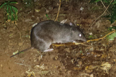
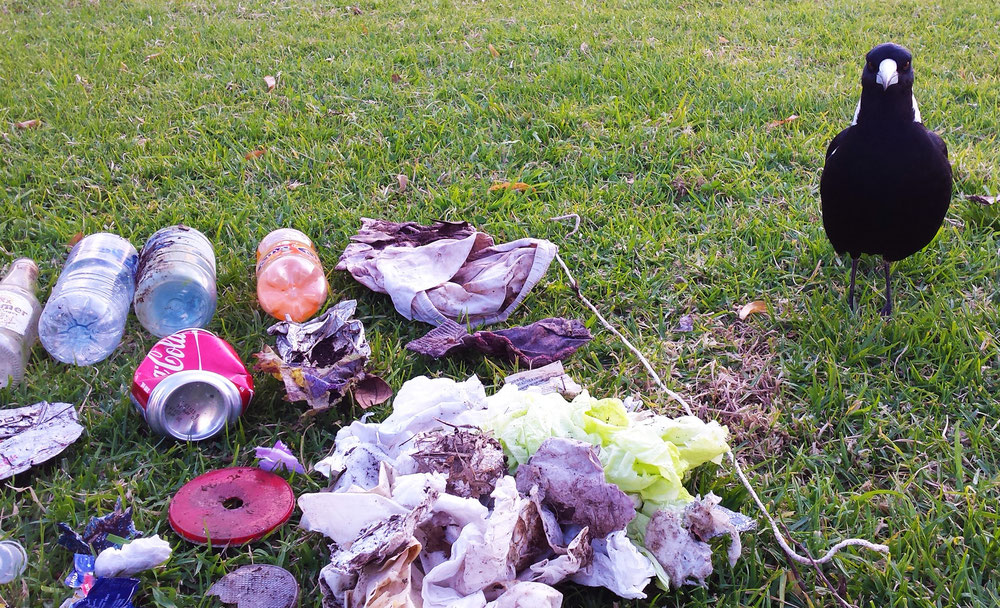
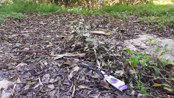
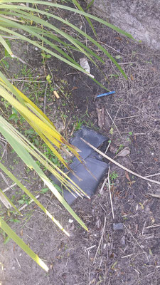
Despite the signs ordering to take all rubbish and litter home, rubbish (bottles, boxer shorts, cans, toilet paper…) left behind by visitors.
It's sad to see that the wildlife doesn't do the difference between the food and the rubbish (as you can see on this
picture with our friend "Momo").
At the end of the day, we admired the sunset at Kamarun Lookout…
Brissy and the Gold Coast
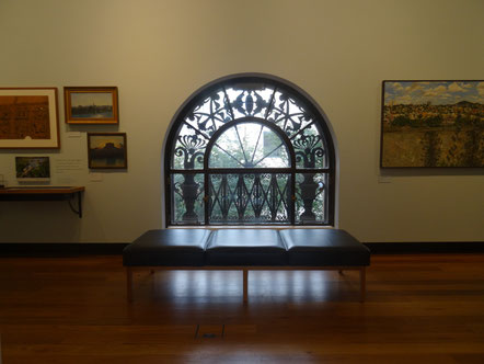
Brisbane, a pleasant and modern city where South Bank's cultural institutions and restaurants meet riverside and park.
As for The Gold Coast is THE tourist destination thanks to sandy beaches, great surfing and sun.
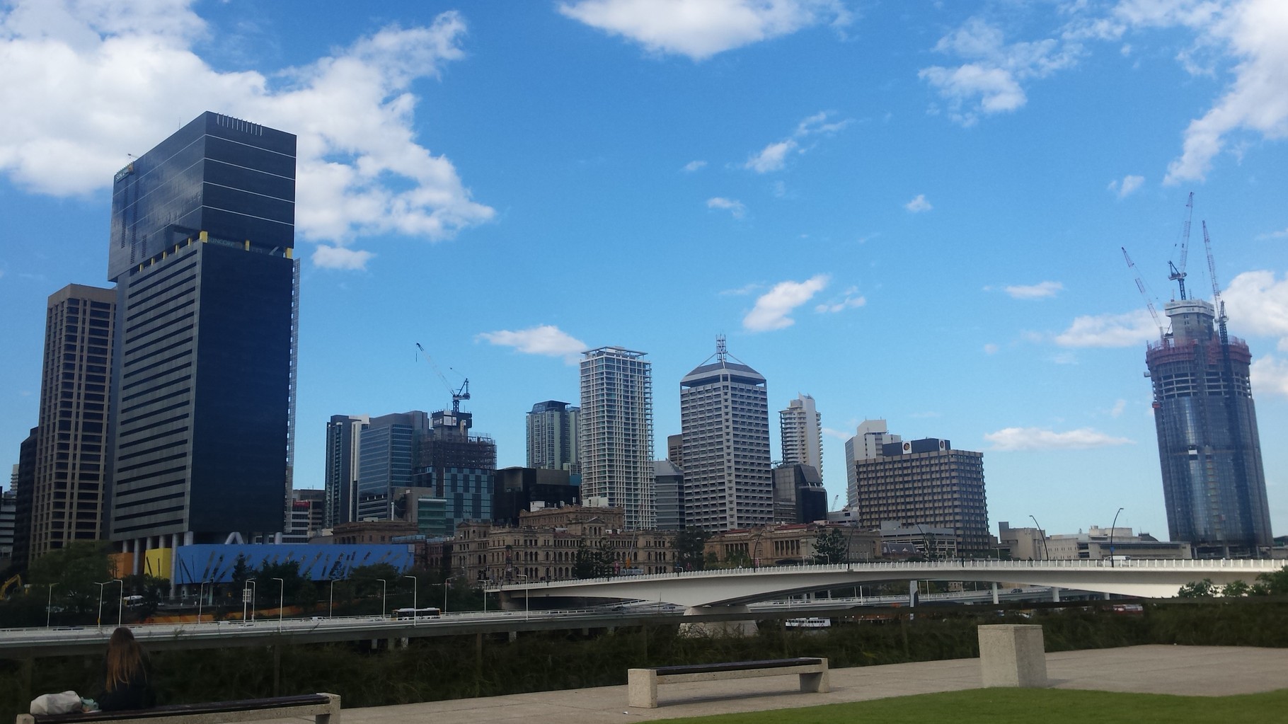
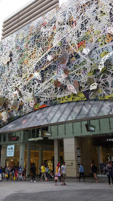
After some kilometers on the Gympie Road, here we arrived in Brisbane (or "Brissy"), the capital of Queensland.
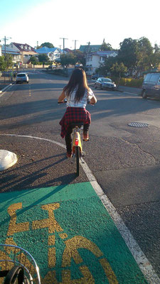
We went all over the city by bike thank to CityCycle (brisbane's public bike share scheme) and bicycle paths along the streets and the river.
Cycling was a eco-friendly, fast, pleasant and cost-efficient travel option to discover this city…
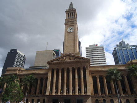
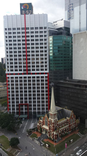
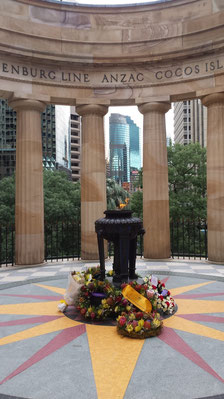
In the Brisbane City Hall, we enjoyed the Clock Tower Tour (entry free).
This 15 minute tour allows to ride the lift up to the clock tower (92 metres high, the clock tower was the tallest structure in Brisbane until the 1960s) providing a unique and amazing view of
Brisbane.
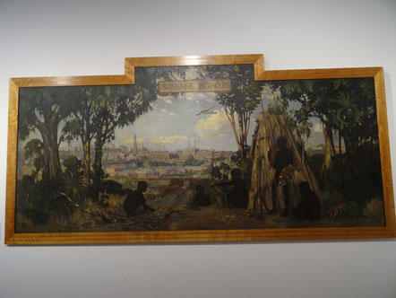
There is also the Museum of Brisbane. Museum of Brisbane showcases the living history of the city, examining how Brisbane and its people continue to change over time.
Brisbane is full of treasures, take a stroll through the city and you will discover them...
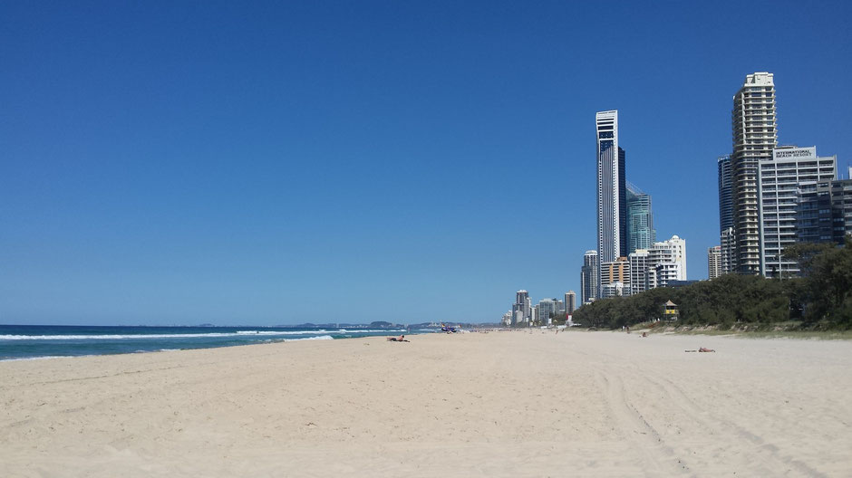
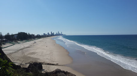
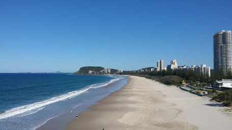
After Brisbane, we went towards the heart of the Gold Coast: Surfers Paradises, where we've seen its beautiful beaches surrounded by high waterfront towers.
10 km further, we was at the Lores Bonney lookout in... Miami!
Time for us to keep driving to discover our latest National park in Queensland : Lamington. This sunset on the road is a good sign...
Next article -> Lamington National Park
The East Coast, Queensland
After a quick visit to a garage because of a flat tire, it was time for us to start the East Coast...
➳ Step 1: From Daintree to Mission Beach
On the road to Cairns, the Rex Lookout offers an amazing view...
At Mission Beach, another great lookout : Clump Point, equally impressive.
And we finally arrived at the mythical beach of Mission Beach!
➳ Step 2 : Mission Beach to Airlie Beach
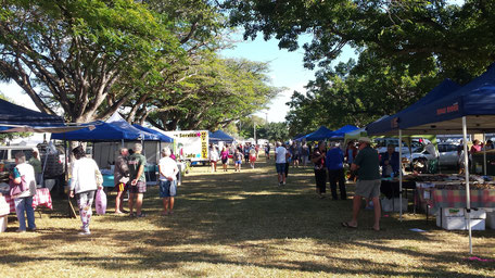
The next day, early morning, we discovered the city of Lucinda. Small outdoor market, huge park along the beach, what do you expect more?

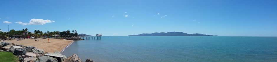
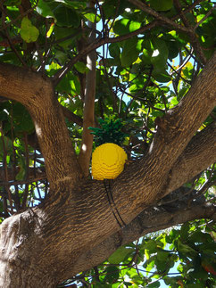
After an awesome breaky, we went to the largest city of North Queensland : Townsville. The Strand, lively, offers a pleasant walk. You can even see some legos in the
trees...
And on the road to Bowen, as usual, we stopped to admire the view...
We finally ended the day in Bowen with a quick snorkeling session before reach Airlie Beach to spend the night.
➳ Step 3 : Airlie Beach to Rockhampton
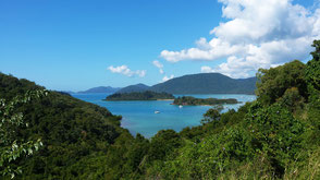
Airlie Beach is a popular destination for travelers in Australia. Indeed, this little seaside town is the departure point for... the Whitsunday Islands. These islands are one of the most popular destinations in Australia (you'll understand why here).
Then, we reached Rockhampton (beef capital) where we stayed 2 days (to write a few articles for you ;) .
➳ Step 4 : Rockhampton to Noosa Heads
We met some mates.
You have to know that they are really often IN THE MIDDLE of the road...
Finally in Noosa Heads - small coastal town, about 136 kilometers north of Brisbane - how to resist?
We went to the Noosa Heads National Park. This small treasure of Queensland offers great activity : walks, surfing, sandy beaches, rocks, tropical forest...
But obviously, tourism and beautiful place rhymes with... clean-up!
➳ Step 5 : Noosa Heads to Bribie Island
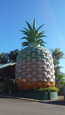
We never get bored on the road... Australians love "Big Things". So we always find new Big Things : pineapple, kangaroo, mango, dinosaur...
In Bribie Island, the beautiful Woorim beach (East Coast) is really impressive!
And many surprises are in the West coast as well...

➳ Step 6 : Wild Horse Mountain
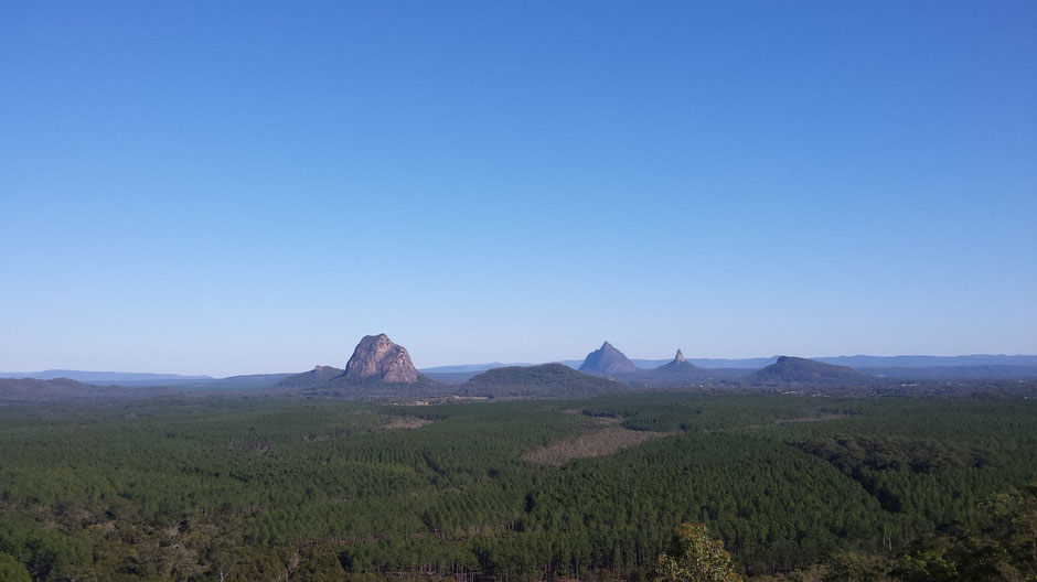
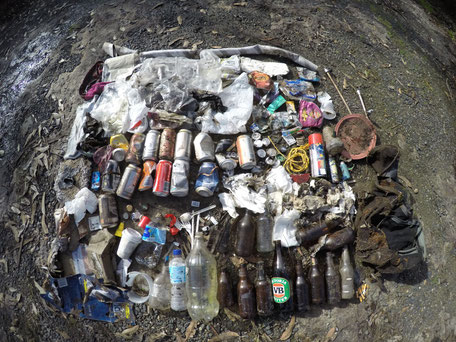
We spent the night at the bottom of the small Wild Horse Mountain (123 meters above sea level) which offers a spectacular view of the Glass House Mountains. Early morning, discovering waste all around, a little cleaning was necessary...
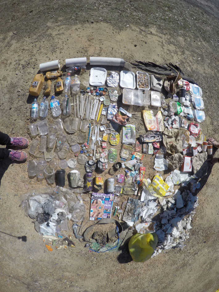
Should we say HUGE cleaning? This "small" clean-up was finally the biggest from the beginning...
And finally the result: 9 kg of rubbish!
Coming soon -> Brisbane
Daintree National Park
Daintree National Park houses the oldest rainforest on the planet ! In 1988 the Daintree National Park as part of the Wet Tropics was granted listing on the World Heritage Listing by UNESCO.
After one night in Cairns, we got back on the road on the Captain Cook Highway where we could notice the many sugar cane fields to Daintree.
The next day, we crossed the Daintree River via a vehicular ferry to Cape Tribution (36 km away) close to the white coral sand beach where the World Heritage Rainforest
meets the Great Barrier Reef.
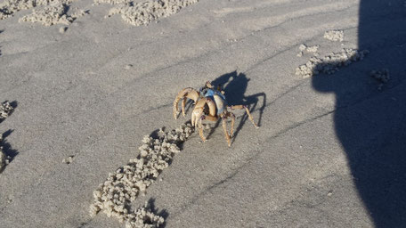
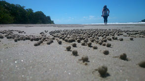
On the road, we stopped at the amazing Waluwurrigga Alexandra Range lookout point and Cowbay and Thorton beaches.
We were surprised by the little sand balls arranged in pretty patterns on these beautiful beaches. Yes, the crab are real artists!
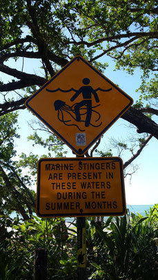
On these beach, be careful with the crocodiles and also with the box jellyfish ! And on the road, drive carefully in Cassowary country!

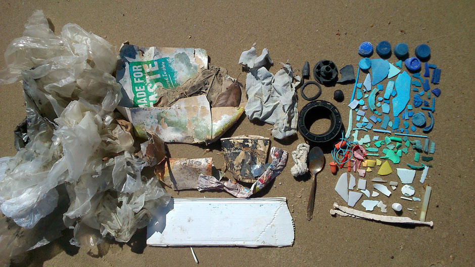
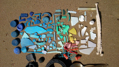
That afternoon, we explored deserted Emmagen beach, where we did a little clean-up. The rubbish and the microplastic pieces come from the ocean.
We swam in a freshwater swimming hole at Emmagen Creek, just north of Cape Tribulation. A short walk from the Kulki car park takes us to beautiful
Myall Beach. Then, we did the nice Dubuji Rainforest Walk.
At the end of the day, we went to Noah Beach Campground (and this one only has a small number of campsites, what happiness!)
Early morning, we enjoyed the sunrise on Noah beach under the palm tree.
Motivated and determined, we started the Mount Sorrow ridge trail hike. "The Mount Sorrow ridge
trail provides opportunities for fit, experienced and well-prepared bushwalkers to experience rainforest-clad slopes and spectacular views from an elevation of 680 metres!"
Our efforts were well-rewarded by this amazing views :
More pictures here
Next article -> The East Coast, Queensland
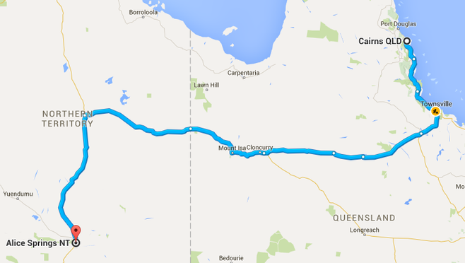
Alice Springs to Cairns
2418 k's, 30 hours of desert road, two States (Northern Territory and Queensland)
➳ Day 1 : from Alice Springs to Devils Marbles (413 km)
Back on the Stuart Highway, major highway of 2834 km from Port Augusta to Darwin !
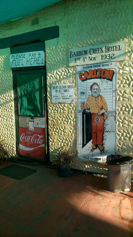
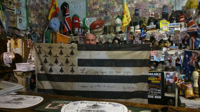
On the road, we stopped off at Barrow Creek. The bartender show us his spectacular worldwide souvenirs collection left behind by visitors. What happiness! He raised the
breton flag!
For your information, at any given time the publican and his staff represent the totality of the Barrow Creek population.
Approximatively 25 km's south of Devils Marbles, we crossed Wycliff Well. It is known as Australia’s UFO capital due to the hundreds of UFO sightings that have
occurred there since WWII.
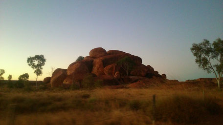
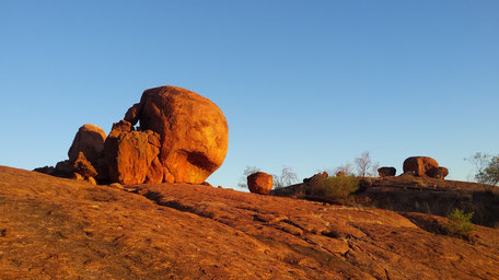
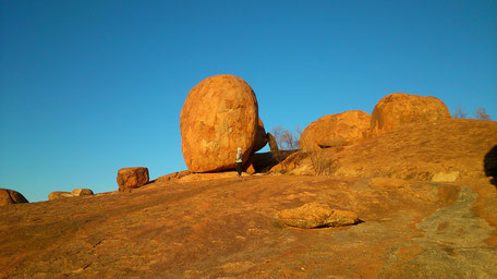
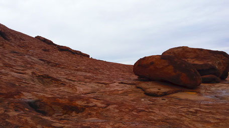
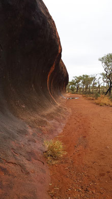
Finnaly, we arrived at Devils Marble. The Devil's Marbles is a collection of large round, red-coloured rocks called boulders. According to Aboriginal legend, the Devil's
Marbles are the eggs of the Rainbow Serpent.
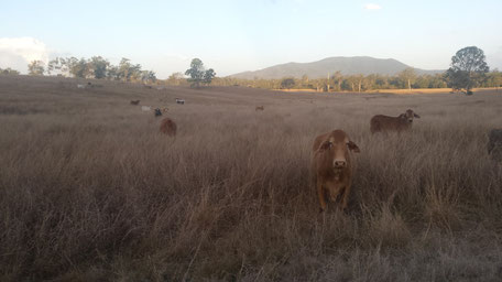
15 km's north of this magical place, we stopped for the night in company with cows.
➳ Day 2 : From Devils Marbles to Camooweal (566 km)
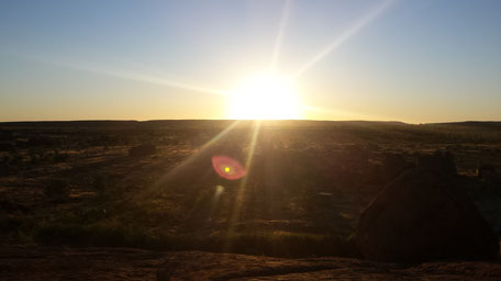
We got back to Devils Marble to admire the sunrise.
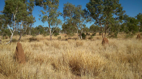
Back on the road to Tennant Creek, we saw termite mounds. Nests are formed in this soil mounds, there are specifically designed to regulate temperature.
Tennant Creek is an old gold mining town.
We visited the Nyinnka Nyunyu Cultural Centre to experience the culture of the local Warumungu people and gain an understanding about their strong connection with the land.
Then the Bill Allen Lookout offers us a clear 360 degree panoramic view of Tennant

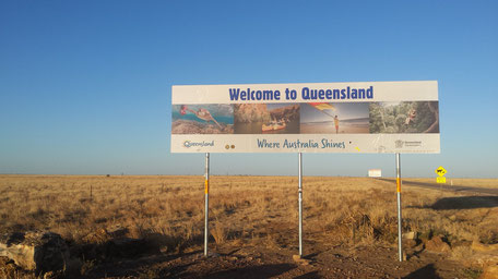
30 km's north of Tennant Creek, the intersection of the Stuart and Barkly Highways called The Three ways : east into Queensland, the north into Darwin et south into Alice Springs. We headed east along Barkly Highway towards Cairns.
At sunset, we stopped at Camooweal, a little town, the first Queensland town after the Northern Territory border.
➳ Day 3 : From Camooweal to Richmond (596 km)
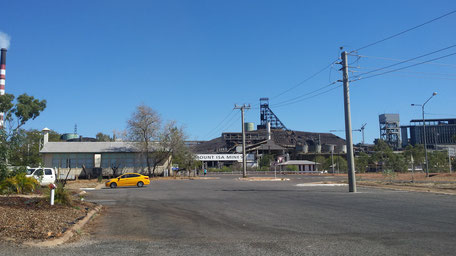
Early in the morning, we got back on the road, to Mount Isa, Au petit matin, nous avons repris la route, direction Mount Isa, industrial and commercial capital of North
West Queensland, largely dependent on mining.
Mount Isa claims to be the largest city in the world, covering an area the size of Switzerland (41 000 km²) !
We finished off our day in Richmond, the fossil capital of Australia.
➳ Day 4 : from Richmond to Townsville (529 km)
After one night under the stars of Richmond, we was back on the road...
After we crossed Hughenden and Charters Towers, we stopped in Townsville, the largest city in Queensland (outside of the South East). Back to reality,
we definitely left tranquillity of the desert!
And then, we slept at Saunder beach, a quieter place.
➳ Day 5 : from Townsville to Cairns (330 km)
We got up at dawn and made our way to the beach to watch the sunrise.
Then, we got back on the road to Cairns.
Panjoo Lockout
After 4 days and half, we finally arrived in Cairns, where we can feel the tropical feel of this city.
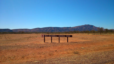
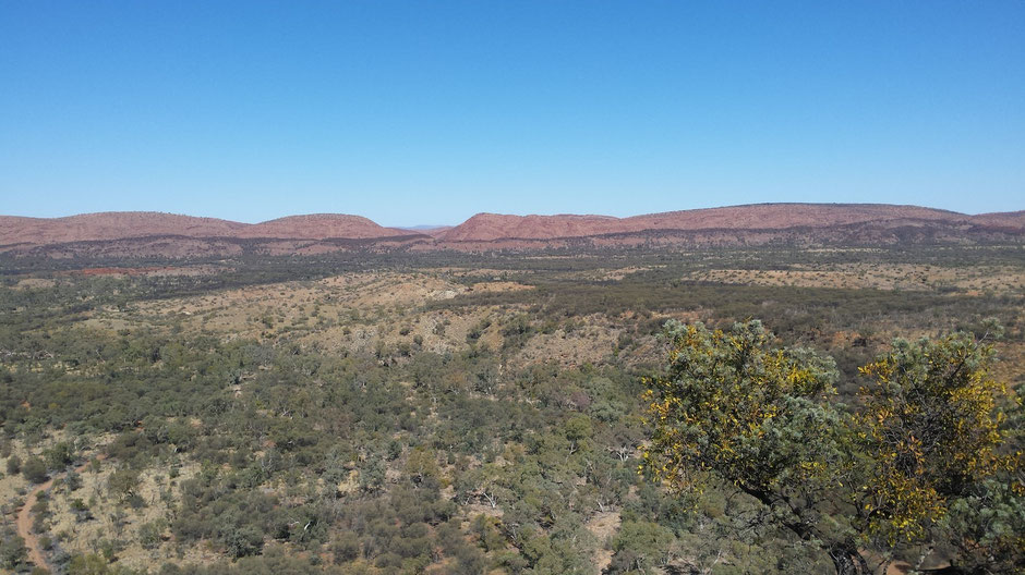
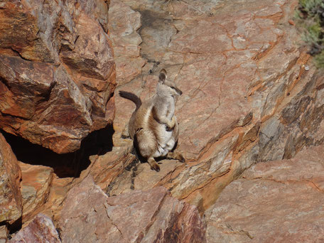
The West MacDonnell National Park, NT
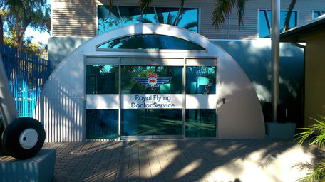
After two days discovering Alice Springs (Anzac Hill, Telegraph State, pedestrian streets) and the Flying Doctor Service Visitors' Centre , we explored The West MacDonnell National Park.
The spectacular Ranges stretch over 640 km running east-west through Alice Springs.
Local residents refer to the MacDonnell Ranges in two distinct parts : East Macs and West Macs and Alice Springs is the perfect base from which
to explore both of these regions.
The West MacDonnel Ranges offer many opportunities to explore the scenic beauty and history of the area: Simpsons Gap, Standley Chasm, Ellery Creek Big Hole, Serpentine Gorge, Ochre
Pits, Ormiston Gorge, Redbank Gorge, Glen Helen Gorge...
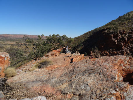
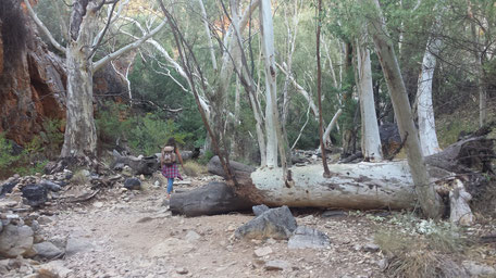
After approximately 100 kms on a spectacular and winding road, we decided to stop before the nightfall at Neil Hargrave Lookout, a nice campground on a cul-de-sac overlooking the West Mac.
Unfortunately, we was surprised by the amount rubbish on this magic place...
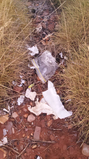
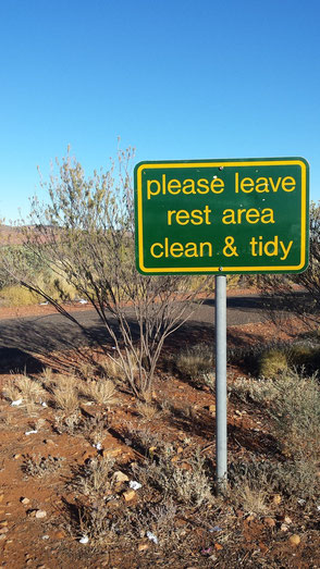
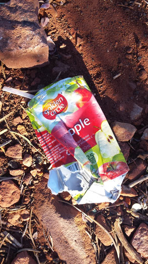
So early in the morning, we rolled up your sleeves and cleaned up this campground.
Aggressive ants, sweltering heat, toilet paper and all types of rubbish... This cleanup was actually quite a bit harder than you can imagine...

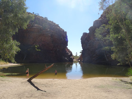
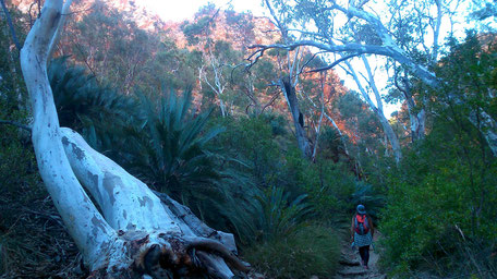
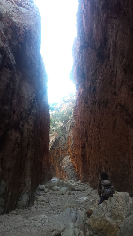
After our clean-up, we started our excursion by the Redbank Gorge. A 2 km walk from our carpark alongside the creekbed led us to this
stunning gorge.
After the walk, we met Michael... This crazy american had just finished the iconic 223 km Larapinta Trail that follow the rocky spine of the West Mac from Alice to Mount Sonder.
We offered him a lift to Glen Helen Gorge, then we got back on the road and set up camp at Serpentine Chalet bush camping area.
- Glen Helen Gorge -
The next day, we explored :
- The Ochre Pits that desert Aboriginal people once used as a quarry for ochre pigments.
- Serpentine Gorge with the spectacular view from the top of the Lookout
Walk
- Ellery Creek Bighole to take a refreshing dip
At the end of the day, we went to Standley Chasm, a deep red cleft crowded on either side by craggy slopes, located 50 kms from Alice Springs.
Next Article -> From Alice Springs to Cairns
Alice Springs and the RFDS
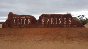
Alice Springs, with a population of 28 605 (Aboriginal Australians make up approximately 18.8%), straddles the usually dry Todd River on the northern side of the MacDonnell Ranges.

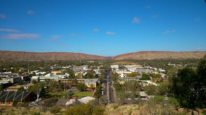
Early morning, we climbed Anzac Hill, to have a good insight into the cleanliness of Alice, located at a gap in the MacDonnell Ranges.
25 km's north of Alice, we took our breakfast in a lovely place, the Telegraph Station.
The Alice Springs Telegraph Station Historical Reserve marks the original site of the first European settlement in Alice Springs.
The next day, we decided to visit the Royals Flying Doctor Service (RFDS) base.
After a short presentation and a walk around the Museum, we watched a short film showing RFDS beginnings including amazing stories of survival.
This year the service will make around 250 000 patient contacts across Australia, that is one new patient every 2 minutes which reflects the vital importance of the RFDS.
The RFDS began as the dream of the Rev John Flynn (Featured on the $20 Note), the first base was etablished in Cloncurry, Queensland, however this base has since been relocated
to Mt Isa.
Today, the RFDS now has 21 bases nationally and the crews cover 80% of the Australian continent.. Alice Springs, together with Port Augusta and Adelaide in South Australia, combine to provide the
three operating bases that make up the RFDS Central Operations which covers the Northern Territory and South Australia.

Today, consultation and diagnosis is mainly by telephone and radio, the doctor is the only person who can authorize an aircraft to bring patients to hospital.
By the way, radio communications play an important role in the outback. One example, The school of the air* is a great help for children living on remote farms or
properties.
The unique aspect of the RFDS is that it is free for all Australian citizens covered by our National Health Service, Medicare, or people from countries with reciprocal rights under Medicare,
whether they are living or traveling in the outback.
The area they cover has a radius of approximately 800kms from Alice Springs, approximately, 36 000 people live in this area, not including the population of Alice Springs. In Alice Springs, they
operate with 6 engine aircraft manned by 11 pilots and the medical team consists of 11 full time flight nurses.
* School of the Air is a generic term for correspondence schools catering for the primary and early secondary education of children in remote and outback
Australia.
Article suivant -> The West MacDonnell National Park
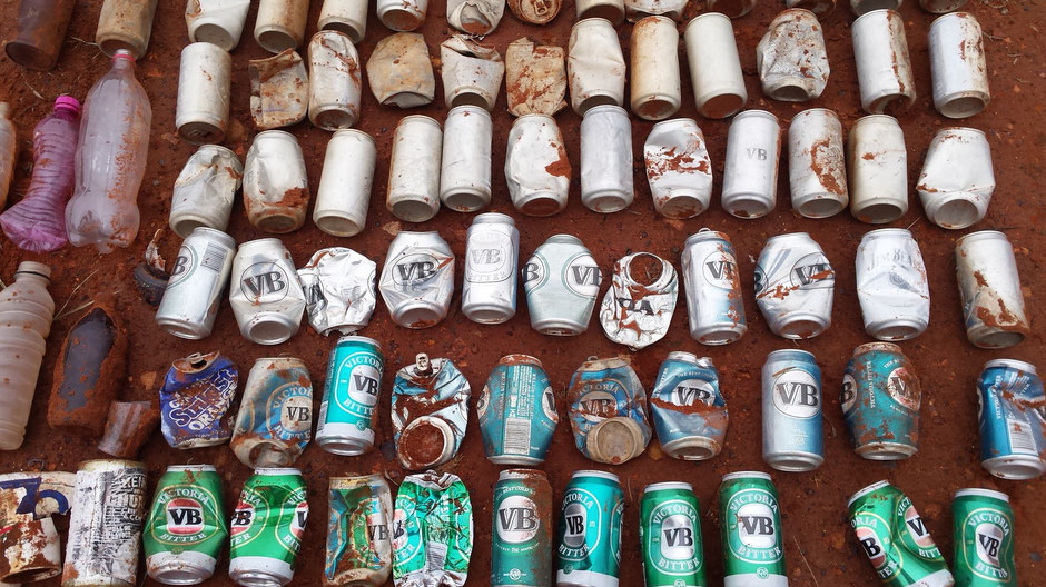
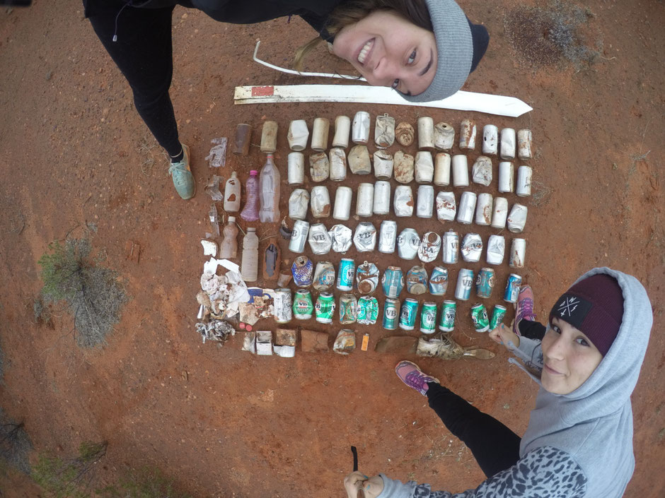
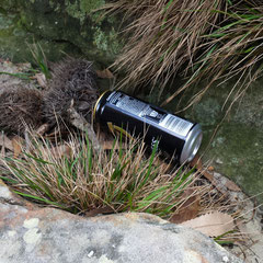
Cans, cans, lovely cans!
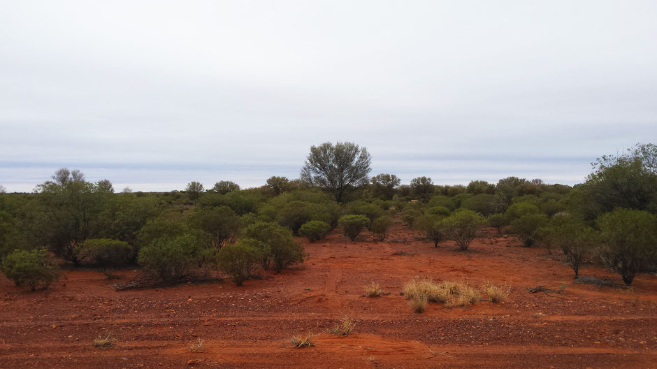
Here, in the middle of nowhere we decided to stop over for breakfast (the day after Kings Canyon). At first all goes well, the place is peaceful, looks quiet and the vastness around us is still impressive.
BUT
Some unexpected waste was there... Really unexpected...
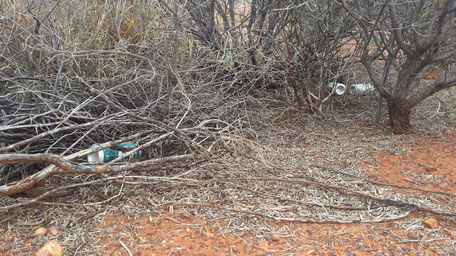
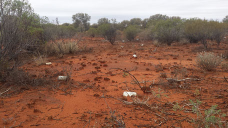
Yes, you can see beer's cans everywhere... In nowhere... In the middle of nothing...
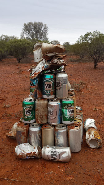
In total we collected 70 cans of beer!
For most it was VB (cheap popular beer). Some probably dating back from several years, and other very recent.
This cleanup is a mystery to us... Why and How so many cans are there, in the desert, in middle of nowhere, without any surrounding civilization?
After spending several days and nights in the company of those lovely waste in the campervan, we finally rid it in Alice Springs.
When recycling reward ...
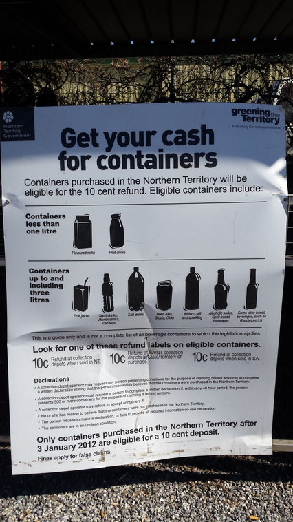
In Australia, in some states where "container deposit legislation" is active, you can go to a recycling center and reap 10c per container (aluminum cans, plastic bottles...)
Container deposit legislation in Australia
CDL is in place in the Australian state of South Australia and The Northern territory and was used in the state of Victoria many years ago but was rescinded. NSW has announced plans to start a scheme in 2017. Queensland has recently announced it will pursue a scheme possibly in partnership with NSW for implementation round 2017-2018
Next article -> Alice Springs and the RFDS
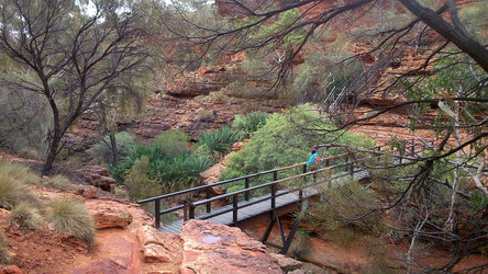
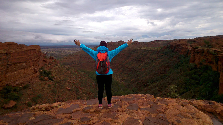
Kings Canyon, a breathtakingly place in Australia’s Red Centre
Approximately midway between Alice Springs and Uluru, Kings Canyon is one of the natural wonders of Red Centre.

After more than 300 km and in spite of rain, we arrived in Kings Canyon!
Kings Canyon is part of the Watarrka National Park. This ancient formation of tall red rock faces that soar above dense palm forests of palms is an conservation area and refuge for 600 species of native plants and animals.
The sandstone walls were formed when small cracks eroded over millions of years. Derived from an Aboriginal word referring to the umbrella bush that thrives here, the Luritja Aboriginal people have called the Watarrka National Park area home for more than 20,000 years.
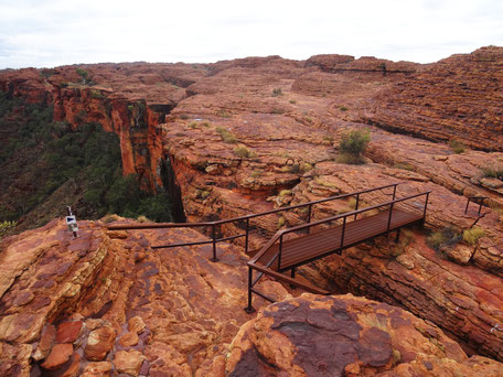
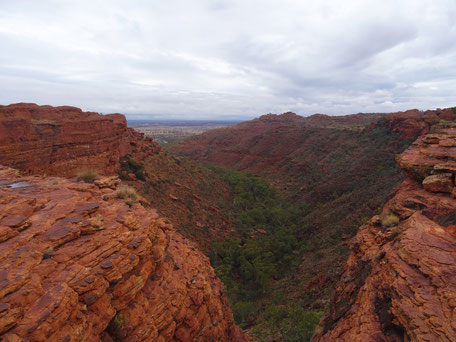
Very steep at the beginning, the challenging six km Kings Canyon Rim Walk, through spectacular landscapes takes around 3 hours.
We descended to the canyon to the Garden of Eden, a permanent waterhole surrounded by lush plant life.


In spite of some rubbish along our way, we fully enjoyed this awesome hike.
VICTORY !
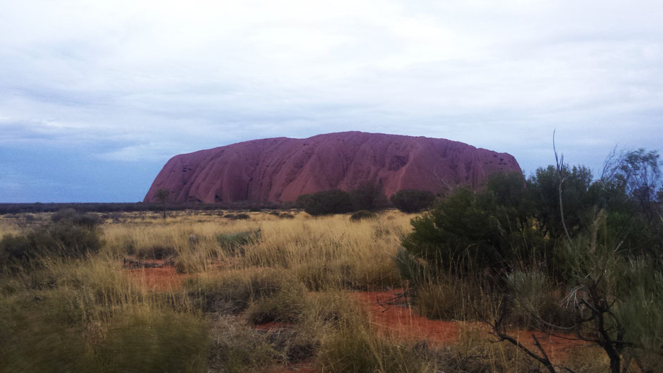
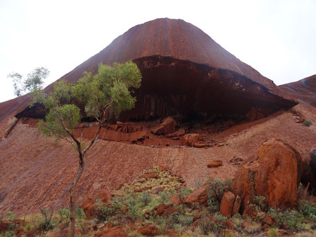
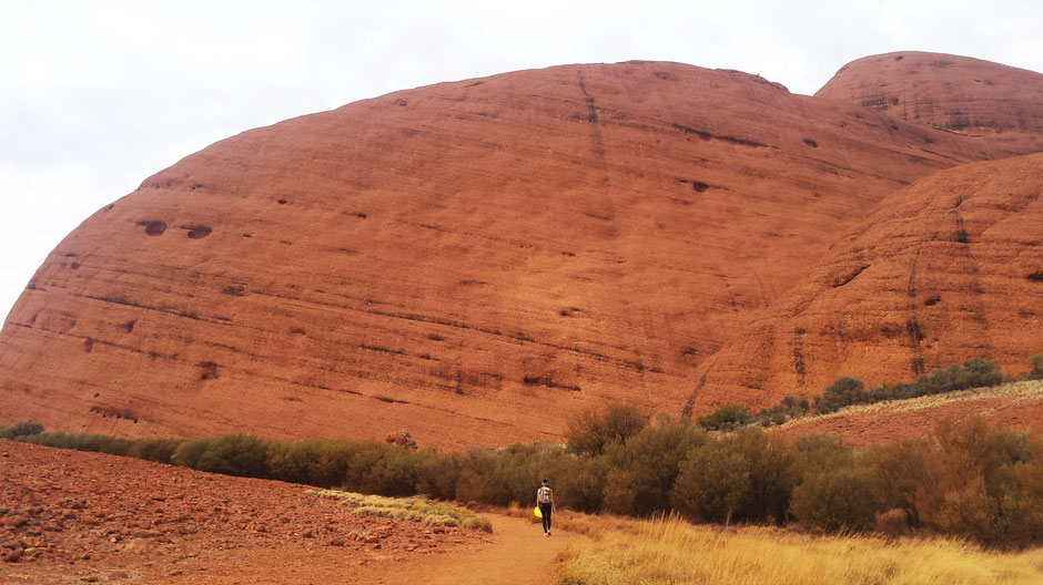
Uluru-Kata Tjuta national park - PART.2
Après l’exploration des Kata Tjuta, il nous restait un petit rocher à découvrir… Uluru (ou Ayers Rock)!

Like Kata Tjuta, Uluru is a sacred site for the Aboriginal Anangu (Pitjantjatjara & Yankunytjatjara). According to their beliefs, mountains, vegetation, wildlife, and mens were created at the same time during the period of Tjukurpa : the creation period.
Uluru officially became a national park in 1950, and it's 8 years later that the entire park (Kata Tjuta + Uluru) was excised from an aboriginal reserve.
Anangu have lived on these lands for thousands of years, archaeological evidence shows their presence in Central Australia for at least 30,000 years. However, it took them more than their 35 years to be recognized traditional owners of the Park...
It was only in October 1985 (historic moment known today as "the handback") that the Australian government restored the land to the Anangu. Today Anangu own all of Uluru and Kata Tjuta and lease it back to Parks Australia to be jointly managed as a national park.
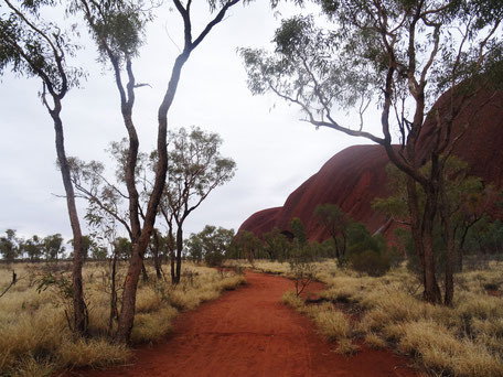
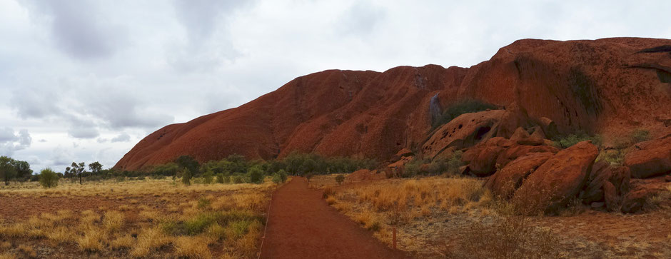
As we love hiking, we opted for 3 walks during our day at Uluru :
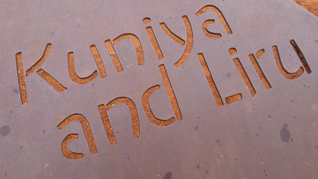
- The Kuniya Walk : 1 km return | 30-45 mins | wheelchair accessible
-
The Base Walk : 10,6 km
- The Mala Walk : 2 km return | 1.5 hrs | wheelchair accessible
Early on the morning we went to the sunrise observation spot, but due to the cloudy weather we have not seen anything (same for the sunset)...
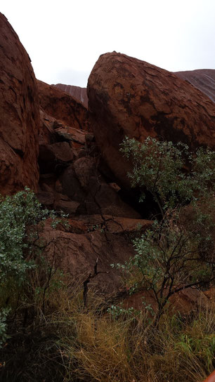
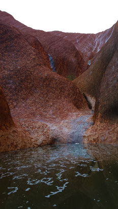
So we started our day early morning by the Kuniya Walk that leads to Mutitjulu waterhole home of a wanampi, an ancestral watersnake.
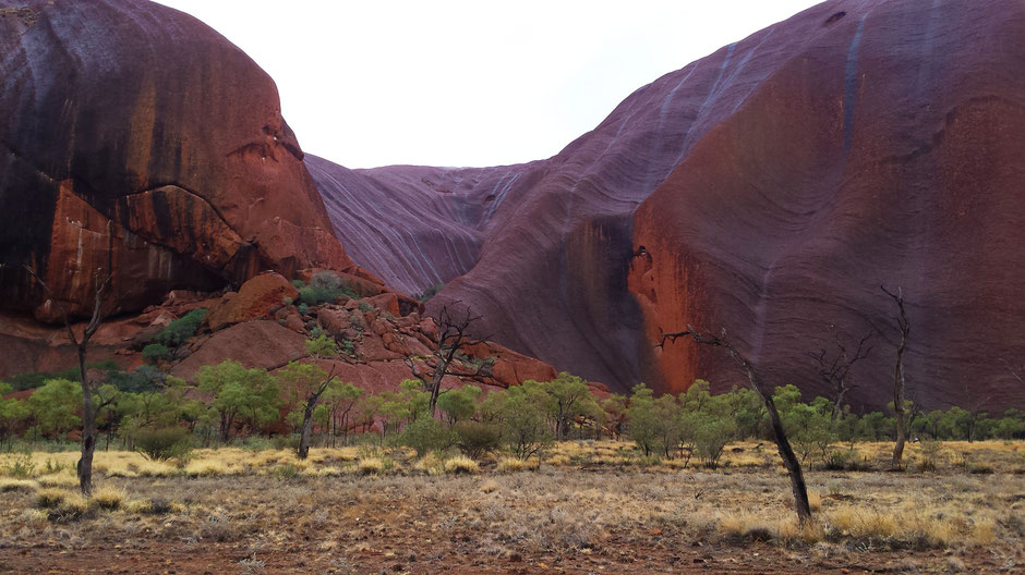
Uluru is a great place to discover a lot of legends whose Anangu are the guardians.
During the Kuniya walk, you can learn how Kuniya and Liru (the woma python woman and poisonous snake man) helped create Uluru.
Here is the story :
Minyma Kuniya the woma python woman came from the east near Erldunda. A bad feeling grew in her stomach - something was wrong. She had to go to Uluru.
Kuniya created inma (ceremony) to connect her eggs together. She carried them to Ulutu in a ring around her neck and placed them at Kuniya Piti.
Meanwhile, Kuniya’s nephew arrived on the other side of Uluru. He was being chased by a war party of Liru (poisonous snake) men from out near Kata Tjuta. He had broken the law in their land and they were sent to punish him.
The Liru men threw spears at Kuniya’s nephew. One pierced his thigh and many others hit the side of Uluru.
One Liru warrior, Wati Liri, was left to care for the injured python man. But he did not do his duty and left the injured man on his own.
Minyma Kuniya realised that her nephew had been injured and was not being cared for properly.
She raced to Mutitjulu Waterhole and saw Wati Liri high up on the cliff. She called out to him about her nephew, but he only laughed.
Minyma Kuniya placed her wana (digging stick) upright in the ground in front of her. Kneeling down, she picked up handfuls of sand and threw it over her body, singing and making herself stronger.
She was creating inma (ceremony) to help her confront Wati Liru.
Kuniya moved toward Liru singing and dancing akuta - a dance step used by women ready to fight.
Kuniya hit him one over the head with her wana. He fell down but got back up. She hit him a second time and killed him.
Kuniya then went and found her injured nephew. She picked him up, dusted him
off and carried him to Mutitjulu Waterhole.
She created inma and combined their two spirit into one. They became Wanampi, the rainbow serpent, who lives in an protects the waterhole today.
This story teaches a traditional form of payback punishment - a spear to the thigh. The punisher must then look after the injured person until they are well enough to care for themselves.
It also teaches about women’s intuition and that a woman may use force to protect her children.
This is a powerful story, Kuniya is still here. Her spirit is here.
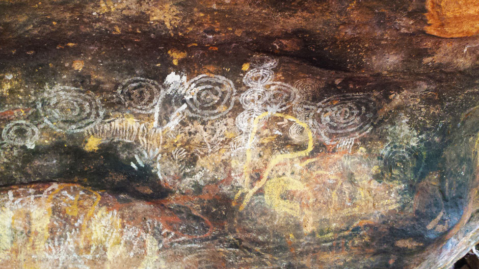
This is the family cave. For many generations, Anangu families camped here. The men would hunt for kaka (meat) and the women and children would collect mai (bush foods). The food would be brought back here to share.

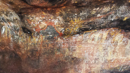
At night around the campfire, generations of Anangu people told stories, teaching the children about this place and painting on the rock.
Today these stories are still kept and handed down to the children.
Stories on stone :
The colors come from a variety of materials : Tutu (red ochre) and untanu (yellow ochre) are iron-stained clays that were very valuable and traded across the land. Burnt kurkara (desert oak) provides purku (clack charcoal), and tjunpa/unu (white ash). The dry materials are placed on a flat stone, crushed and mixed with kapi (water).
How old is Uluru's rock art?
The symbolism used in Uluru's rock art is thought to date back at least 5,000 years.
After this short walk, it was time to start the Base Walk (10.6km - track around the base of the rock) and the Mala walk 2km.
This walk with caves, sacred sites, natural waterhole, rock art and beautiful landscapes is the best way to learn about symbols, beliefs and stories of Uluru.


Uluru, véritable emblème de l'Outback australien domine le paysage désertique qui l'entoure.
Uluru, symbol of the Outback dominates the surrounding desertic landscape.
The second largest monolith in the world have impressive dimensions: Uluru rises 348 metres above the plain, more than 860 metres above sea level, and his circumference is not smaller than 9,4km. BUT apparently this is not all... Some experts believe that the rock extends further 6km underground!!!
Others impressive facts :
-
Temperatures can reach up to 47 degrees Celsius in summer, but they can drop to minus seven degrees Celsius on winter nights.
-
Fauna : 21 mammals, 73 reptiles, 178 birds and 4 frogs live in the park.
- Flora : More than 400 and many have traditional uses for Anangu.

As in Kata Tjuta, we thought to not find rubbish in our way considering the sacredness of the site and the signs everywhere...

We were wrong...

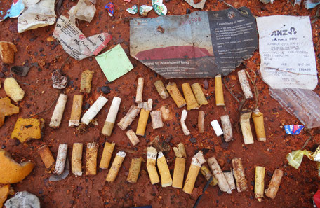
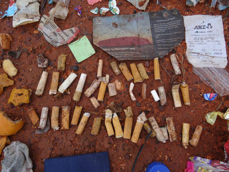
Cleaning summary:
- Toilet paper - very pleasant - ever-present...
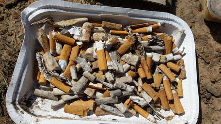
- Cigarettes : score of 39 butts
- The most disgusting remains : toilet paper and a used tampon
- The most "annoying" for us : the scrap iron that is not recycled everywhere
Each year, over 250 000 people around the world visit Uluru, imagine what this site would become if everybody threw its waste ... but let's think in a positive way : imagine the number of potential hands that can pick up waste along their way...
;)
Next article -> Kings Canyon
Uluru-Kata Tjuta National Park - PART.1
After two days at Coober Pedy, we got back on the road for 750 km to our next stop that we was waiting impatiently…
ULURU-KATA TJUTA NATIONAL PARK!
On the road to Uluru, we stopped one night at Curtins springs station in the middle of nowhere.

The day after, we arrived at Uluru-Kata Tjuta National Park.
Uluṟu-Kata Tjuṯa National Park, located in Northern Territory of Australia, by UNESCO as a World Heritage Area for both its natural and cultural values.
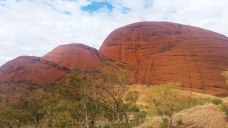
We started our exploration by impressive walks in Kata Tjuta (The Olgas).
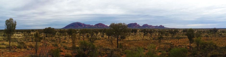
Kata Tjuta is a Pitjantjatjara word meaning 'many heads'.
The 36 steep-sided domes of Kata Tjuta lie about 32 kilometers west of Uluru. The highest point, Mount Olga, is 1066 m above sea level. This is an Anangu men's site and is sacred under Tjukurpa
(law).
A number of walks allow us to explore Uluru Kata Tjuta National Park:
- Walpa Gorge walk (2,6 km)
- The Valley of the Winds walks : Karu lookout (2,2 km), Karingana lookout (5,5 km) and the full circuit walk (7,4 km).
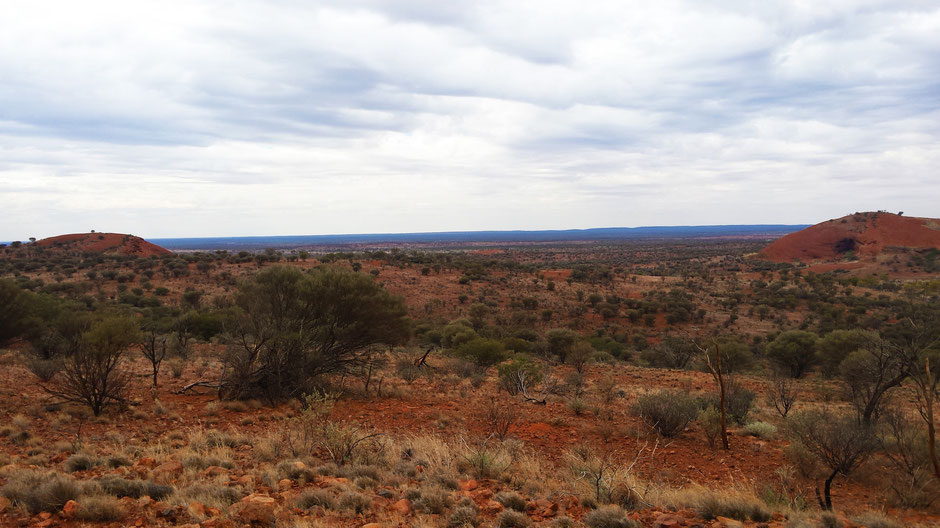
Early morning, we started the full circuit walk in The Valley of the winds.
The remainder of the Valley of the Winds walk took us far away from everyone and into the heart of this land. Even with a cloudy day, this hike was impressive: weaving between the red head (some of which are 500 metres high), an abundant vegetation, some steep spots, lookout area over the central Australian desert and the far horizons. Without hesitation, we recommend it! Have a look to this amazing landscapes:

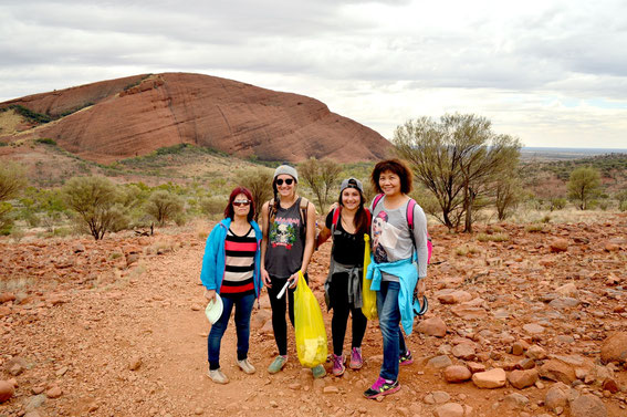
During this hike, it was a pleasure to meet Cecilia and Michael. We shared our project with them.
Few days later, we received an email with a picture…
"We appreciated what you had done to the environment, please keep on."
Thank you!
After this amazing walk, we explored the Walpa (windy) Gorge.
This short rocky walk (only 2,6 km) is a desert refuge for plants and animals.


This first day into the heart of Uluru-Kata Tjuta National Park in two words:
serenity and discovery!
BUT…
Yes, there is a “but”. Sadly, the amount of rubbish spoiled our feeling of serenity during this day…
We experienced this amazing, impressive and living cultural landscapes. In despite of the beauty of the sites, we haven’t never seen as many rubbish as there are this walk. .
We thought we could leave our bin bag to enjoy the full walk… It’s sad and sickening!
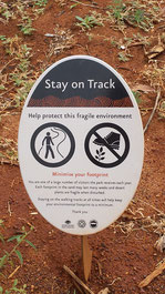
Despite the clear message*, people never stop polluting only the track. People don’t stay on marked tracks.
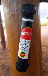
*“Minimal environmental impact techniques involve many common sense practices such as staying on marked tracks and roads, taking rubbish home, respecting cultural sites, not transporting weeds or firewood, picking up cigarette butts and not damaging plants.”
These techniques can be applied as much to the landscape as to interactions with Anangu. For generations, the people of Uluru and Kata Tjuta have lived in a delicate balance with the natural
environment by adhering to laws laid down in Tjukurpa. These laws ensure that the balance between human beings and the environment is maintained.
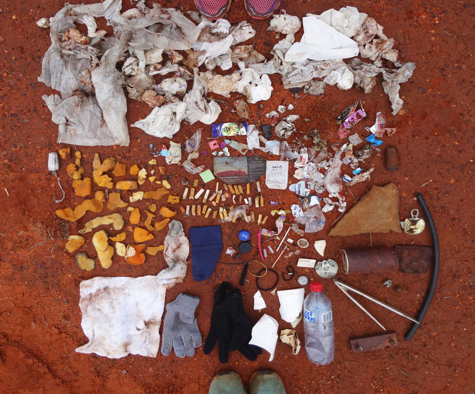
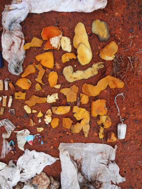
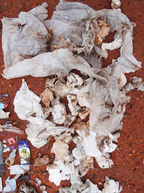
We can notice on this picture, the problem for us was toilet paper in the bush.
Summary of this clean-up:
-
The toilet paper, the big winner: 155 sheets of toilet paper. “Clean up people shit” is now
familiar to us.
- Thanks to girls. Clean up hygiene products is so nice.

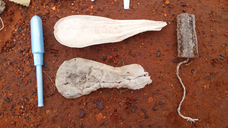

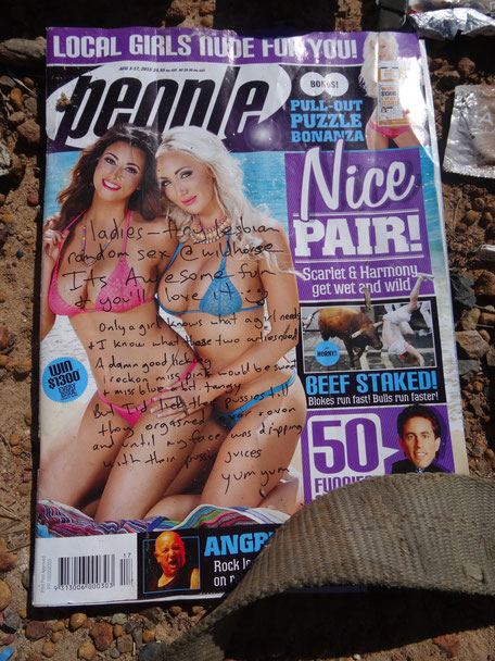
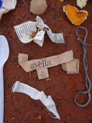
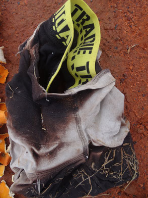
And we didn’t get it:
clothing labels
and a boxer short
No worries…In despite all this, the Kata Tjuta is impressive and we will keep this memory.
New partnership: NOMAD AttituDD!
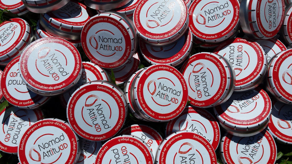
We are proud to announce our new partnership with... NOMAD ATTITUDD.
Nomad AttituDD who are they ? what they do ?
Hubert and Nicolas (the founders) had been fighting cigarette litter for
about 5 years.
There you go, Nomad was founded in 2010 to fight the cigarette butt and litter.
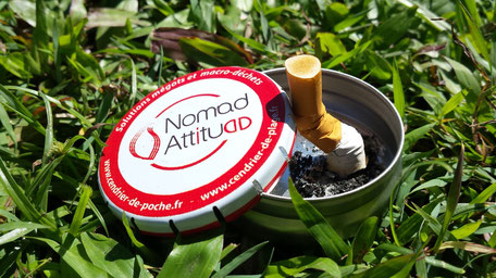
Nomad AttituDD provides solutions to cigarette butt litter : pocket ashtrays...
Their goal? Provides the means (for responsible people and business owners) to reduce... the cigarette butt litter !
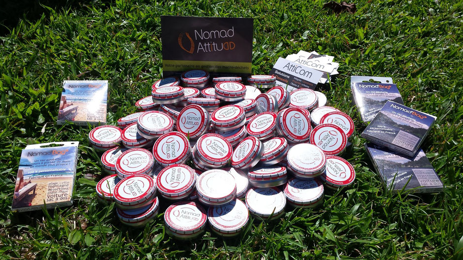
We contacted them and after some talks via Skype and mail.... What happiness! We received a parcel in Melbourne to help us in our goal: have a positive impact on the Australian environment.
Is that all? No! Their last creation, Nomad Bag®, is a distribute portable of litter bags. It's a unique and practical solution to pick up and take all rubbish and litter home.
Why this partnership ?
Butt waste is everywhere: on the streets, on the beaches... The cigarette butts are our public enemy number one!
Like Nomad.
So, we contacted them. For us, the pocket ashtray is THE SOLUTION to fight cigarette
litter.
Thank to Nomad Attitudd, we have
around a hundred of pocket ashtrays and also around ten Nomad Bag®.
Our goal is to make the travelers aware of the importance of conserving a clean and intact environment. Nomad is helping to make that happen !
After sharing our project with travelers, we are happy to give them these products. They alway enjoy our "gift".
The pocket ashtrays are part of the solution to end cigarette butt litter! And it's eco-friendly, small, light and recyclable!

As for Nomad Bag®, it's the
solution to pick up the macro and micro rubbish.
These pocket trash bags (completely biodegradable) all types of small rubbish (butts, micro plastic, tissue...).
Check out their website : cendrier-de-poche.com.
Here, we can learn about environmental problem of cigarette butt litter and find all their products!
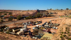
Coober Pedy or the underground life
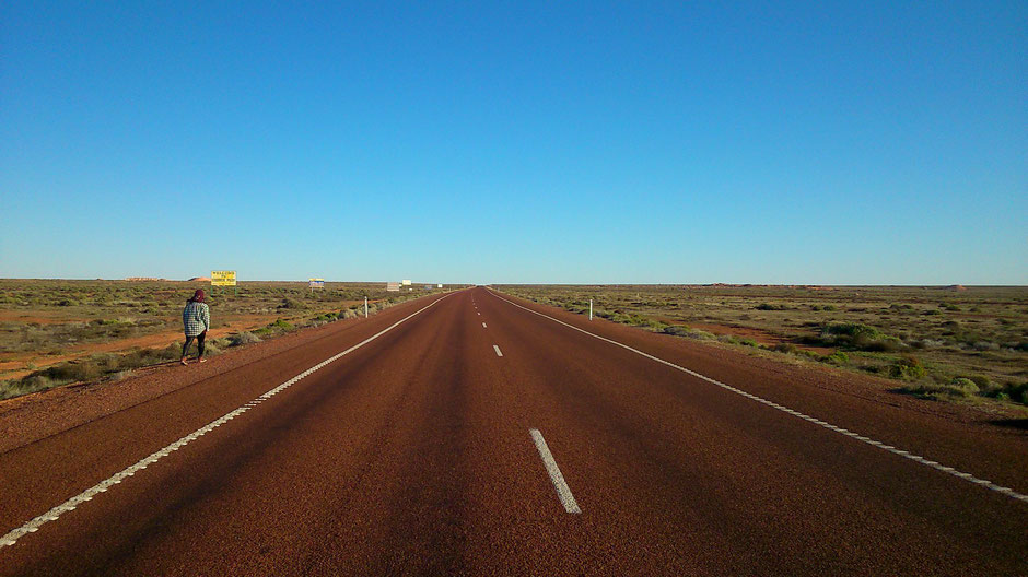
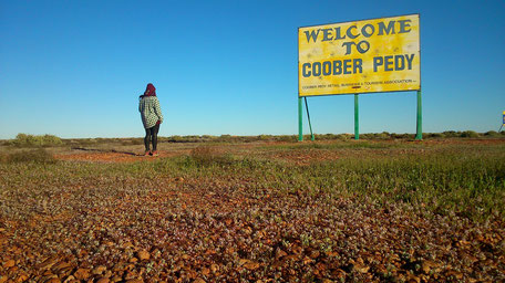

After one night at Port Augusta (the basis of South Australia's industrial heart) and 847 km of deserted “roads” (via Stuart Highway and National Highway), we arrived in Coober Pedy!
Coober Pedy “or the underground life”? It experiences freezing nights in winter and scorching days in summer forcing its residents to live in an underground home or “dugout” as the locals call them. Whether it's below zero or above 50°C outside, the temperature in an underground home is always perfect. The name "Coober Pedy" comes from the local Aboriginal term “kupa-piti”, which means "white man's hole”. We can even find a golf course, completely free of grass!
However, Coober Pedy is famous its opal fields, Coober Pedy is known as the Opal Capital of the World. Coober Pedy produces most of the world's opals.
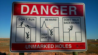
Signs in Coober Pedy forbid to walk backwards, due to haphazard opal mining all over town!
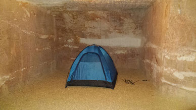
How to live a unique experience? By sleeping in a dugout! So we pitched our tent at Riba’s Underground Camping.
Welcoming by Barbara and Rick, we booked an on-site opal mine tour.
Rick live in the hope of making their fortune!
After one night underground, we got back on the road to explore this fascinating town where half the population lives in underground dugouts.
What's to see? Lots!
- John McDouall Stuart Monument, the most accomplished and most famous of all Australia's inland explorers.
- the cemetery
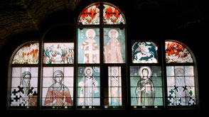
- the underground churches : Saint Peter & Paul's Catholic Church, Serbian Orthodox Church and Revival Fellowship Underground Church
On the road, we had a look to The Big Winch close to The Old Timers Mine (an original opal mine dating back to 1916). The Big Winch is 8 metres high and sits atop a hill that overlooks the town.


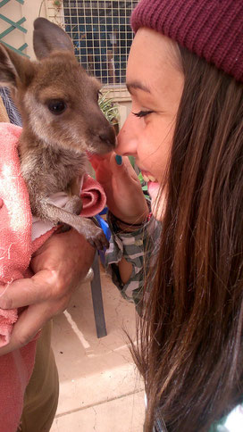
At lunch time, we went to Josephine's Gallery & Kangaroo Orphanage where we could hand feed and cuddle the kangaroos.
Then, we got back on the road to The Breakaway, “The Moon Plain”, 33km north of Coober Pedy.
The desert-like moonscape along the fence, with its fossilised shells, grey, soft clay dirt and cracks that appear to be bottomless, has been nicknamed the “moon plain”.
It too has been the scene for numerous movies “Mad Max”, “Fire of the stone”…
The 70km round trip back to Coober Pedy takes us east along the hills to the dog fence. This 2m high wire barrier stretches for over 5,300km across three States, to protect the sheep country in the south from the native dog, the Dingo.
On the road, we stopped-off at Crocodile Harry's Underground Nest. Crocodile Harry was quite a character (he spent over 13 years in the north of Australia hunting crocodiles) and lived in one of the most eccentric dugouts. We could find souvenirs and messages on t-shirts and pants left behind by visitors, and a lot of bric-a-brac
Harry sadly passed away in 2006 but his Dugout is open to the public.

We finished our exploration by a great guided tour of the Faye's Underground Home (the only dugouts open to the public), built thirty years ago by three women. This home was excavated in the original method using picks and shovels. We discovered three bedrooms, a kitchen, a wine cellar... and even a swimming-pool!
There is a lovely Australian couple living in this home.
Our big-hearted tour guide, explain us how Faye, an extraordinary women, went out of her way to finish this wonderful and impressive home.

In summary, Coober Peddy is a town full of story!
Adelaide, South Australia.
Our first stop-off in South Australia was The wonderful Blue Lake in Mount Gambier.
Mount Gambiers’ Blue Lake has long fascinated scientists and laymen alike. Its depth its source of water and above all, its colour have all attracted much speculation and research. The lake is a volcanic crater found by an eruption around 4800 years ago, extremely recent in geological terms.
-
Average depth: 80 meters
-
Surface area: 70 Ha
-
Capacity: 36000 mega-liters
-
The Surface of the water is 56 meters above sea-level and 25 meters below the road.

Then, we got back on the road to Adelaide.

Adelaide is the capital city of the state of South Australia, home to more than 1,2 million people.
Adelaide, the city, you’ve been looking for! Pedestrian streets, small bar and restaurant, lively café scene, street art, friendly local people, a peaceful atmosphere, lush green parklands, local markets…
Moreover, we were so lucky to meet Zack and Vincent, two talented musician mates from the group HOWL N BONES. Check out their Facebook Page! These two mates gave us a really warm welcome. We discovered with them the sensational life in Adelaide: walk through the streets and laneways, live performances, pub… This perfect combination of all these good things makes Adelaide, the greatest city throughout our road trip.
Howl n Bones deserve their success! We are looking forward to meet them for live shows in France...

FOLLOW THEM ON FACEBOOK! Like, share, spread the word, do all your best so that Howl N Bones come and kick your ass in France!
Check out this amazing performance:

And this official video clip (completely crazy! As we love!):
Thank you for this fantastic time in Adelaide, we looking forward to seeing you guys again!
♥

Next Article -> Coober Pedy
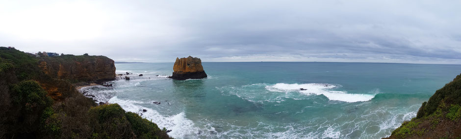
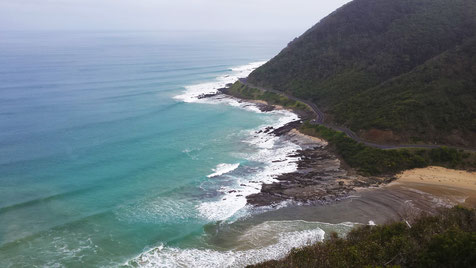
The Great Ocean Road, Victoria.
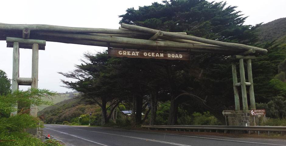
The last step in Victoria: The Great Ocean Road.
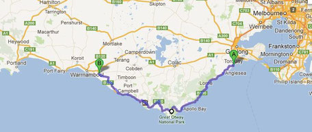
The Great Ocean Road is one of the world’s most scenic coastal drives. This drive is an Australian National Heritage listed in 2011, 243 km stretch of road along the south Easter coast between Torquay and Warrnambool. The Great Ocean Road is famous for the iconic beaches, the misty waterfalls, the native wildlife, the national parks…
After one night in Torquay (the surfing capital of Australia and home to Bells Beach), we started a new adventure on The Great Ocean Road.
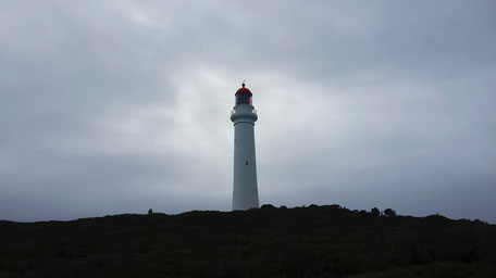
➳ 2nd stop-off: AIREYS INLET - Split Point Lighthouse, Eagle Rock Marine Sanctuary, Aireys reserve

➳ 3rd stop-off : LORNE - Teddy's Lookout, Erskine Falls

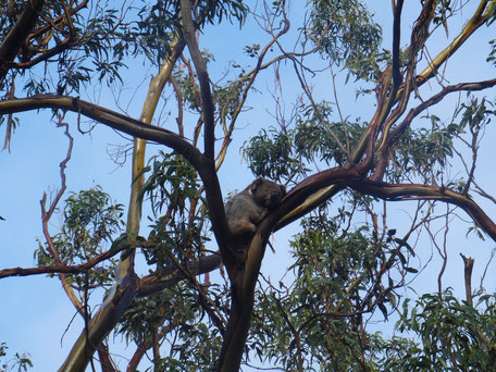
➳ 4th stop-off : Kennet River - The Grey River Road is a popular Koala spotting area.


➳ Etape 5th stop-off : Short walk at MAITS REST
➳ 6th stop-off : Cape Otway : Lighthouse


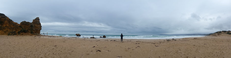
➳ 7th stop-off : Cleanup in Johanna Beach
Johanna beach is a popular beach surfing and fishing spot.
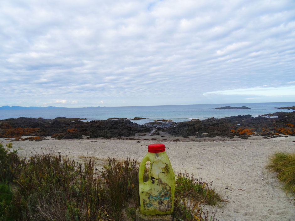
Succumb to the charm of this beach, we cleaned up on our way… This clean-up was different, the trash was from the ocean. The marine debris found on the beach was mostly plastic.
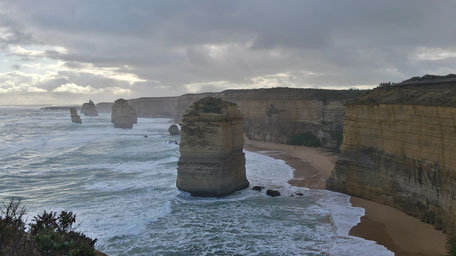
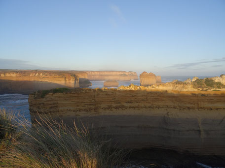
➳ 8th stop-off : The 12 Apostles
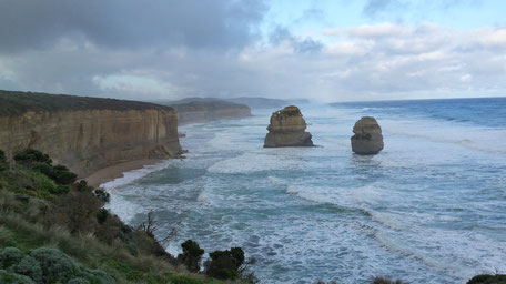
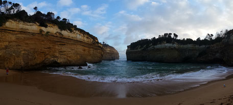
➳ 9th stop-off : Loch Ard Gorge

The Razorback

And the best for the end... Sherbrook River!
Next article --> Adelaide
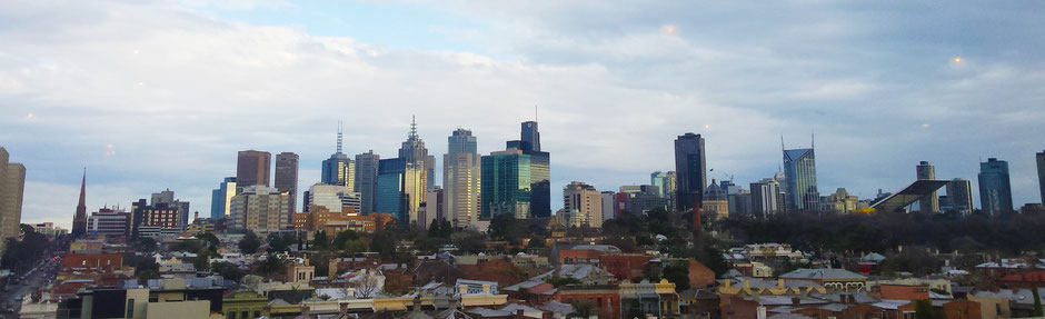
Melbourne, Victoria.
We spent 4 days in Melbourne, the capital in the Australian state of Victoria. We have succumbed to the charm of this awesome city.
Meeting new people is one of the most exiting parts of our trip…
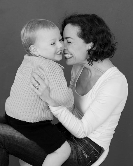
Maud is born in France, she have been living in the UK and Australia for the last decade. She discovered our project and offered a couch to sleep at her home.
Parenthood is one of the most amazing adventures in your life, full of unknown, full of surprises, full of joy, full of challenges. So Welcoming Bébé is born.
The company support mothers (in Melbourne) through the challenges that motherhood brings to every mum and they prepare expecting mums to thrive in motherhood.
We support 100% Welcoming Bébé and Maud as
life coach. Don't forget to follow Welcoming Bébé on Instagram and Facebook!
It's been a rich emotional experience for us. Maud and her family was warm and welcoming.
Thank you so much to them (Maud, Andrew and Hugo).
We met also two French girls : Marion and Laurie !
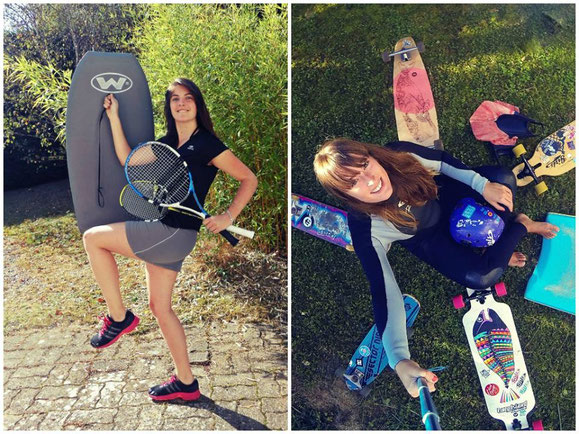
They arrived in Australia at the same time but they decided to launch also a project but a sport project.
This two adventurers set themselves a challenge: test all the different sports in Australia: surf, running, skate board, parachute jump…
Don’t hesitate to follow their adventure via leroadtripaustralien.wordpress.com and Facebook !
And our last days in Melbourne, we slept in an awesome backpacker: Bev and Mick's. The best hostel we’ve stayed in, in Melbourne and in Australia so far. A combination of an excellent location, fantastic atmosphere, lovely and friendly staff… A real family! We would recommend it to everyone stopping off in Melbourne! One of the cheapest backpacking hostel in Melbourne !!

A big thank you to Sophie, Dany and the rest of this big family…
Melbourne is a very livable and clean city, we was nicely surprised.
The city have launched an original awareness-raising campaign.
Summary:
meeting, architecture, street art, gastronomy, melting pot, night life, generosity and open-mindedness …
For sure, we will be back!

-> Next Article : The Great Ocean Road
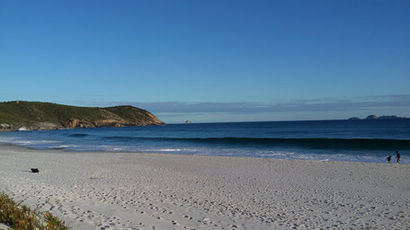
Wilsons Promontory National Park.
After 8 days on the road, back to our last adventures... We left the NSW and drove along the East Cost of Australia.
Morning at Bega
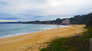
Eden Beach

Eden
Now, we are in Victoria ! After a stop at Lakes Entrance, we head to the coastal wilderness of Wilsons Promontory
in the South Gippsland.
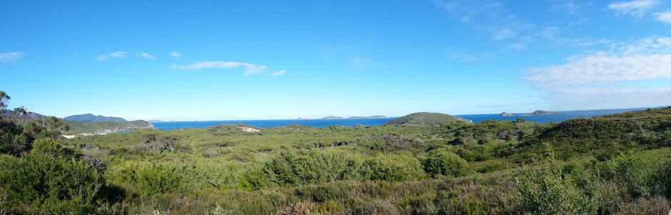
The Prom is one of Victoria's most-loved places. at the southernmost tip of Australia
mainland.
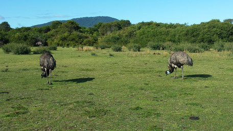
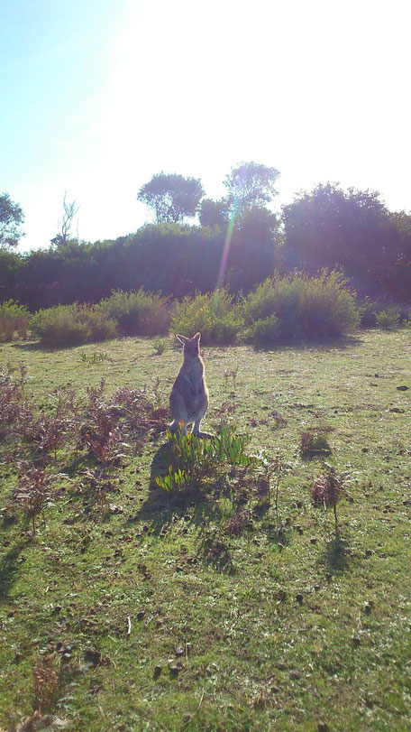
It's home to a wide range of wildlife species, we met emus, kangaroo, wallaby, wombats and... our first koala!

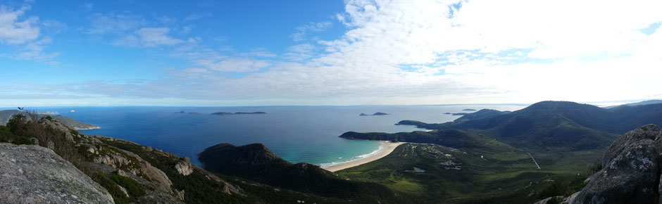
Amazing view in thetop of Mount Oberon
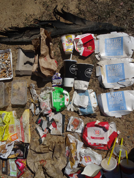
And as usual, we picked up rubbish along our path. Hiking the Oberon Mount, we noticed that most of the waste were "snacks" ...
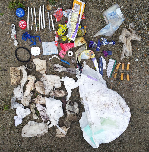
The top rubbish items of this clean up were:
food packaging and lollipop Sticks.
The most disgusting: baby wipe and toilet papers.
The most surprising item : a nappy.
The rubbish were abundant during this hike but the most shocking thing was on the car park...
The awesome place don't stop the thoughtless actions of many visitors concerning the nature...
No fewer than 10 plastic plates,
The most disgusting: the toilet paper
And most sad: plastic bottles nibbled by animals...

Summary of this day : 3kg of rubbish!
Next article -> Melbourne
Canberra, ACT.
We spent one night and one day in Canberra. Canberra is a pleasant and clean city surrounded by greenery.
We went to the National Gallery of Australia and we have discovered this treasure :
"The Universe of wanking pixels"
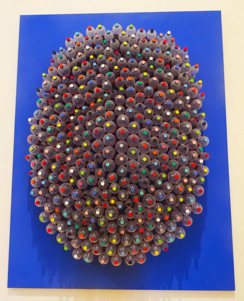
Work by Dale Leonard Frank, an Australian contemporary artist.

After a cultural excursion in Canberra, we are
getting back on the road to Bega, a historic town with a proud tradition of cheese making (the frenchies girls are back!!!).
xx.
Next article -> The Prom'
On the road...

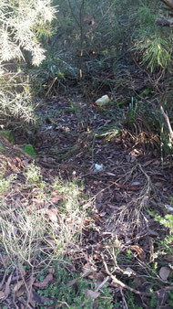
Third day since the departure. After a morning clean up and an exploration at Jervis Bay (Hayms beach, Bristol Point...), we are on the road to Canberra...
Cleanup in Jervis Bay
Third day on the road, we arrives in Jervis Bay by night and on the morning we discovered the awesome Georges Bassin :

Sadly, we discovered too much trash all over this idyllic place : toilet papers, cans, the backpack, solar shower... No doubt this time, this place is turned into a rubbish dump by
travellers !
On the morning, we cleaned up this awesome spot. We couldn't leave without doing that.
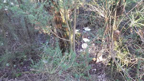
And the summary of this first big clean up on the road is :
- The top rubbish item : the can (15) and the glass bottle (12)
- The quirky rubbish item : a bronchodilator, a elastic band for boxer, one sock, one aerosol spray paint, one bang, one shower solar and one backpack.
- The most disgusting : the toilet paper
And in total, it's 8kg of rubbish!
Back on the road, see you soon.
xx
Le départ approche.../ Tomorrow!
Fin prêtes ! Le grand départ, c'est demain :) !
Ne vous inquiétez pas vous pourrez suivre notre itinéraire, nos actions et nos aventures via notre page Facebook, et aussi via ce blog!
Et pour nos aventures hors projet, rendez-vous sur la page Facebook : facebook.com/frommanlyto, ou sur : frommanlyto.tumblr.com
______
Reaaaaady for tomorrow :)
No worries, you can follow our itinerary, our actions and our adventures via our Facebook page, and also via this blog.
And for our personal adventures, go to the Facebook page: facebook.com/frommanlyto, or on : frommanlyto.tumblr.com
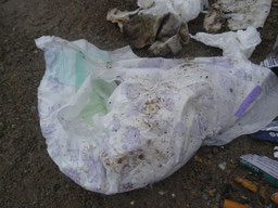
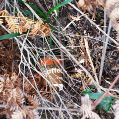
Cleanup in North Head | Nettoyage à North Head
How's your weekend going?
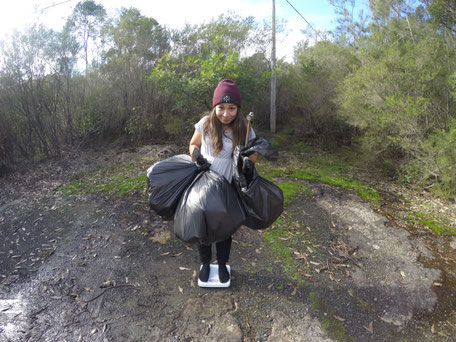
For us: 10 kms walk, with amazing landscapes and where we've rid the nature of some trash. And our winner of this hike is... the can, with no less than 12 picked up on our way!
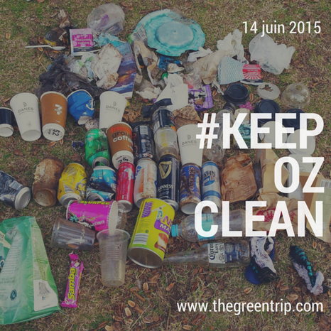
Good Sunday everyone, and don't forget to #keepozclean
_____
Vous passez un bon weekend ?
De notre côté, on ne s'est pas laissé aller : 10 kms de marche, durant lesquels nous avons pu admirer de magnifiques paysages et débarrasser la nature de quelques détritus. Et notre grand gagnant de cette petite rando est...la canette, avec pas moins de 12 ramassées sur notre chemin!
Bonne fin de weekend à tous, et n'oubliez pas votre #deuxiemesac pour la balade dominicale


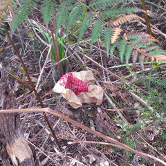

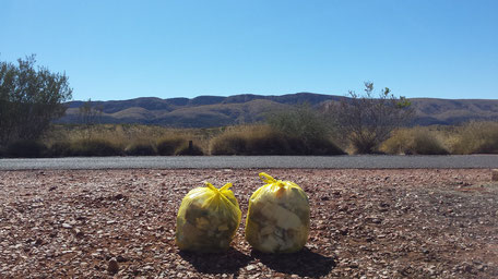
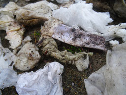
Allier plaisir et bonne action / Hiking and good deed
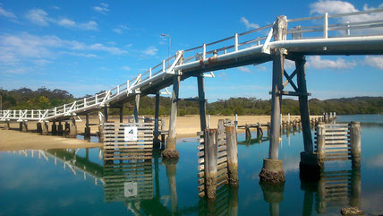
Retour en image sur notre dernière randonnée : Manly to Split Bridge.
Après 10kms d'une merveilleuse randonnée, nous sommes repartis avec 2 sacs-poubelle rempli de déchets, et pas un ne nous a échappé !
Vous voyez? Allier plaisir de marcher à la sauvegarde de l'environnement est à la portée de tous !
#keepozclean
----------------------
Back to our last hike : Manly to Split Bridge
10kms, wonderful hike, and 2 full trash-bags!
You see? It's really easy to spend good times hiking and take care of the nature.
#keepozclean


Et si on montrait l'exemple ? / Let's set an example!
Notre première action à Castle Rock Beach en vidéo!
_____
Our first action at Castle Rock Beach!
À PROPOS

The Green Trip, une initiative responsable mêlant ramassage de déchets et sensibilisation.
En savoir plus

FOLLOW US